Historically significant town lying south of the Dandenong Ranges
Berwick, now effectively a suburb of Greater Melbourne, is a former township which became a city and was subsequently incorporated into the City of Casey which includes Berwick, Harkaway, Narre Warren, Hallam, Doveton, Endeavour Hills, Lysterfield South, Hampton Park, Lyndhurst, Cranbourne, Clyde, Devon Meadows, Pearcedale, Cannons Creek, Warneet, Blind Bight and Tooradin. Inevitably, as the population of Melbourne has grown, it has become a modern urban commuter belt area but its old-fashioned library building, neat gardens and broad High Street (which is more like a boulevard than an Australian main street) has meant that it has a certain 19th-century feel.
Location
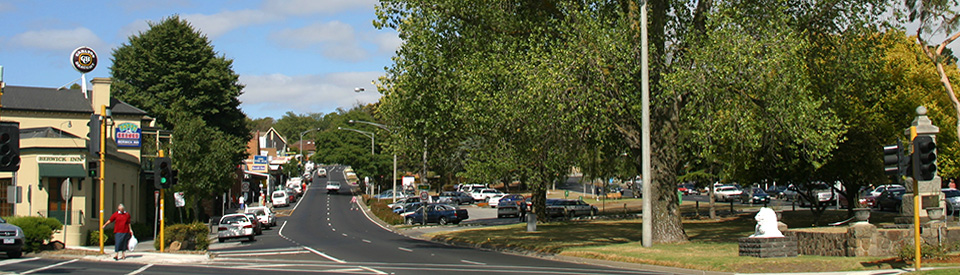
Berwick, now a south-eastern suburb of Melbourne, is a former village located 46 km from the Melbourne CBD.
^ TOPOrigin of Name
Not surprisingly Berwick takes its name from Berwick-on-Tweed, a town in the north of England. One of the first landowners was Captain Robert Gardiner who took up land in 1837 and named his property after his birthplace, Berwick. Prior to Gardiner's change of name the area was known as Cardinia Creek which is said to be an anglicisation of 'kar-din-yan', a local Aboriginal word meaning 'looking at the rising sun.'
^ TOPThings to See and Do
Berwick Heritage Walk
There is a pleasant, 3 km walk around the centre of Berwick which starts in Lyall Street, moves along Brisbane Street to Church Street, cuts up Peel Street and returns to Lyall Street via the wide and impressive High Street. It visits a total of 15 places of interest. It can be accessed at https://www.casey.vic.gov.au/sites/default/files-public/user-files/Arts%2C%20sport%20%26%20facilities/berwick-walking-tour%20(1).pdf and https://www.casey.vic.gov.au/berwick-heritage-walk.
The most interesting include:
1. Pioneers Park, Cnr Lyall Road and Peel Street
Located on the corner of Lyall Road and Peel Street, Pioneers Park was opened in 2005 on the site of the Old Berwick Primary school. The school building, which was built in 1869-1870 with additions in the 1920s. It is now part of the Pioneer Park Café. There is more detailed information at https://vhd.heritagecouncil.vic.gov.au/places/62954. Walking along Brisbane Street to Burr Hill you will pass 15 Brisbane Street and 31 Brisbane Street, both of which have been heritage listed.
2. Burr Hill
Located at 3 Burr Hill Court (it runs off Brisbane Street) is the impressive Burr Hill house which was built sometime between 1854 and 1876 for James Brisbane. It was originally known as Brisbane’s Farm. The last sale suggested it had been built in 1876. Burr Hill was owned by James Buchanan, MLC who was an early Berwick pioneer. The house was donated to the Presbyterian Church in 1914 and was used as the church Manse until 1941. There are also heritage listed houses at 64-70 Brisbane Street and 65-67 Brisbane Street. Check https://vhd.heritagecouncil.vic.gov.au/places/65319 for more details.
3. Church Street – the School and the Avenue of Honour
The handsome building on the corner of Church Street and Brisbane Street was built in 1877 and originally used as a school. It was architect-designed by the Melbourne firm of Little and Beasley. Dr Edward Vieusseux, the next owner of the building, established the Berwick Grammar School in the building in 1882, where it ran until 1928. As you walk down Church Street note the trees which form an Avenue of Honour that was planted in 1919 to honour the nine students of the Berwick Grammar School who were killed in World War One. There is a monument to commemorate the students. See https://vhd.heritagecouncil.vic.gov.au/places/127005 for more information.
4. Old Christ Church, Anglican Church
Located at 8 Palmerston Street (on the corner of Church Street) is the small Church of England, Old Christ Church which was built in 1877 with the Vicarage at 1 Church Street being built in 1888. The Victorian Heritage Database notes: “Particular features of importance include the altar and the leadlight dedication windows. The bell tower, dedicated to important local artist and nurse Jessie Traill is also of interest.” For more detailed information check https://vhd.heritagecouncil.vic.gov.au/places/62921.
5. Avenue of Honour – Princes Highway
The Avenue of Honour comprises 123 hybrid black poplar trees which were planted in 1929 by Miss Ada Armytage. The Avenue recognises the Berwick men who served in the Great War.
7. St Andrews Uniting Church
Originally a Presbyterian Church, and located at 105 High Street service road, St Andrew’s was built between 1879-1888. The architects included a spire in the original plans but this was not built for financial reasons. The significant hilltop site reflects the significance of the role of Presbyterians in the history of Berwick, including the Wilson and Buchanan families. The Victorian Heritage Database notes: “St Andrews has architectural significance as an example of the ecclesiastical work of the notable Melbourne architects, Reed, Henderson and Smart, and is architecturally interesting for its broad four-bay buttressed nave with plate-tracery windows. See https://vhd.heritagecouncil.vic.gov.au/places/62893 for more detailed information.
8. Terence O’Connor Reserve and Avenue of Honour
The Terence O’Connor Reserve at the end of Scanlan Street is the highest point in the town. Scanlon Street is the location of the town’s third Avenue of Honour – 35 English Oaks and Pin Oaks which were planted in 1918.
12. Rechabite Hall, Christians Meeting House and Post Office and Court House
This group of public buildings was built in the 1880’s. The Rechabite Hall (106 High Street) was built in 1886. At the time it was built by the Temperance Movement but it subsequently was used by the RSL and is currently the Masonic Centre. The Christians Meeting House was built for the Church of Christ in 1886 and in 1885 the Post Office and Court House were opened. The Post Office was designed by John Kelleher who designed similar buildings for Murtoa and Donald.
13. Berwick Mechanics’ Institute and Free Library
Located at 15 High Street, the Mechanic’s Institute was established in 1864. In return for a nominal rent Robert Bain agreed, in 1878, to lease a block of his land to the library for 500 years, so long as a library remained on the property for that period. It moved to this site that year. The Institute still operates as a lending Library run by volunteers and includes a Heritage collection of nineteenth century books and a collection of books and magazines from the library of Lord and Lady Casey.
14. The Berwick Inn
Located at the corner of High Street and Lyall Road, the pub was licensed in 1857 as the Border Hotel. The original one-storey section is now the bar. The two-storey section was added in 1877 to cater for increased business due to the arrival of the railway. The first licensee was Robert Bain who owned the town's first store/post office and donated the land on which the shire hall was later built. The Border Hotel was an important local centre in the early days. Aside from being the first pub on the townsite it was also a stopping place for coaches en route to Gippsland. Bain was the first secretary of the Berwick Roads Board (the first form of local government) and its initial meetings were held at the hotel from 1862 to 1865. The first local police court was held at the hotel in 1865 and it also served as a licensing court. The Bain family continued to own the hotel until 1909. When Robert Bain died his wife, Susan, took over.
15. Plantation in centre of High Street
In the centre of High Street, on the corner with Lyall Street, is the town’s War Memorial and behind it is a memorial to the long-forgotten Edwin Flack who won both the 800 and 1500 metre races in the 1896 Athens Olympics, the first Olympic Games of the modern era. He lived in the area and was buried in Berwick cemetery in 1935.
Old Cheese Factory
Located at 34 Homestead Road, the old cheese factory is a two-storey structure built of hand-made local bricks in the 1860s. The construction style is unique in the district. Built at the same time as the factory are the homestead and the kitchen/wash-house. The factory is now an art gallery and the kitchen is a craft shop. There is an English garden with lawns, a formal herb garden, shady trees, an ornamental pond and historic displays and there is the Homestead Cafe which is open from 10.00 am - 3.00 pm Tuesday to Friday and 9.00 am - 1.00 pm Saturday. The other facilities are open seven days from 10.00 am - 4.00 pm, tel: (03) 9702 1919 or check out https://www.casey.vic.gov.au/facilities-hire/old-cheese-factory.
Wilson Botanic Park
Wilson Botanic Park covers 36 hectares and is located at 668 Princes Highway. Walking paths meander through some exceptional terrain including cliffs, gorges, valleys, lakes and a North-American-style marsh. There is plenty of birdlife about and some endangered plant species. It was built on the site of the bluestone quarry owned by the Wilson family who donated the land to the Council for the Park in 1973. There is a pleasant, easy 3 km walk through the park - past the lakes, the flower beds and rose gardens, a bird hide and a stump sculpture - which is described in great detail at https://walkingmaps.com.au/walk/3931.
History
* Prior to the arrival of Europeans the area was occupied by the Bunurong people.
* Captain Robert Gardiner found good pasturage and, in about 1837, took up land on which the township of Berwick would later develop.
* Gardiner appointed Terence O'Connor as his superintendent. O'Connor brought sheep from Tasmania and took up residence on Gardiner's property.
* The area was initially known as Cardinia Creek which was an adaptation of the Aboriginal name for the waterway - 'Kar-Din-Yarr' - which means 'looking at the rising sun'.
* In 1841 a native police force barracks was located to the west of what is now Narre Warren.
* In the 1840s Gardiner established a lookout on Mount Misery to keep watch for ships which mistakenly entered Westernport Bay, thinking it to be Port Phillip Bay.
* A regular overland mail service from Melbourne to Gippsland via Berwick was established in 1848.
* Victoria's oldest agricultural society - the Port Phillip Farmers' Society - was founded in 1848 and one of its branches (the Mornington Farmers' Society) centred on Berwick.
* A small community developed on the eastern side of Berwick Hill in the late 1840s.
* The Eumemmering Hotel opened in 1851 on the Eumemmering run which was later subdivided into residential blocks.
* Surveys were conducted in the 1850s and the government set aside some of Gardiner's run as a townsite which was initially known as 'The Reserve'.
* The Gippsland Hotel opened at Beaconsfield in the early 1850s. The owners had a track cut through to the new goldfield at Woods Point in the early 1860s.
* The first land sales took place in January 1854.
* In 1855 a general store was opened in the area.
* The Mornington Hotel opened in 1855 at what is now Narre Warren.
* The townsite was established in 1857 or 1859.
* A blacksmith's was set up in 1857 as was the first Presbyterian Church.
* The Border Hotel was licensed at Berwick in 1857 to Robert Bain who also owned the store-post office.
* A wheelwright's shop and school were opened in the late 1850s.
* A steam-threshing machine and flour mill were operating in the townsite in 1858.
* The Bunurong people held their last corroborees in the area c.1858.
* A bluestone quarry, established on the Wilsons' property at Berwick in 1859, provided steady local employment.
* Dairying and cheese-making became important in the 1860s.
* A new school was built in 1861.
* Berwick was proclaimed a town in 1861.
* The bushranger Dan 'Mad Dog' Morgan was employed on a property at Harkaway before attacking his employee's wife with a knife and fleeing in 1861.
* Local government commenced in 1862 with the formation of the Berwick Road Board.
* Meetings of the Road Board were held at the Border Hotel until an office was built at the top of Berwick Hill in 1865.
* In 1862 a mechanics' institute and free library was built and a second general store was established.
* A recreation reserve for cricket and other purposes was set aside in 1863.
* The first local police court was held at the Border Hotel in 1865.
* In 1868 the Shire of Berwick was proclaimed and a policeman was stationed at Berwick for the first time.
* Prince Alfred, Duke of Edinburgh, stayed at the Gippsland Hotel in 1869 during a royal visit.
* At Harkaway, north of Berwick, the higher ground was settled largely by German immigrants and a Lutheran church was built in 1869.
* A state school and a Catholic Church were constructed in 1870.
* A Church of Christ church was opened in 1874.
* An Anglican Church was consecrated in 1876.
* The railway to Berwick opened in 1877.
* Gold was discovered at Upper Beaconsfield in the 1870s but the diggings were soon abandoned.
* A Methodist Church was opened in 1886.
* In 1890 the population of Berwick was 636. Oats, peas, beans, potatoes, hay and introduced grasses were cultivated in the shire.
* Tea, hops and wine grapes were briefly grown in the area in the late 19th century.
* After World War I heavy industry moved into the area.
* In 1920 St Margaret's School for Girls was opened.
* An airfield was built in 1938.
* A lace and handkerchief factory opened in 1950.
* An International Harvester Company plant opened in 1952.
* By 1955 a General Motors car plant and the H.J. Heinz factory had opened.
* The suburb was created by the Housing Commission in the 1950s to provide low-cost housing for the factory employees.
* In January 1959 the farm scenes for the Hollywood film On the Beach were shot on the Wilson's property.
* In 1968 Casey Airfield became a commercial operation.
* Berwick was declared a city in 1973.
* In 1994 Berwick was incorporated into the larger City of Casey.
* In 2011 Berwick's population was 44,779.
^ TOPVisitor Information
There is no Visitor Information at Berwick.
^ TOPUseful Websites
There is a useful local council website. Check out https://www.casey.vic.gov.au/attractions.
^ TOP
There seems to be an old abandoned Quarry off Harkaway Rd that is fenced off and closed to the public . More info please.
Former mayors for Berwick Council please