Major service town in the Southern Highlands
For a long time Mittagong has been the Cinderella of the Southern Highlands. Known as the 'Gateway to the Highlands' it does not have the chic charm of Bowral or the historic integrity of Berrima. Rather it is a town which combines its importance as a railway centre with its historic importance for coal and iron ore. Today it is an ideal place to start any exploration of the Southern Highlands. Its Visitor Information Centre is the tourist heart of the district. The town lies between two volcanic peaks - the famous "Gib" (Mount Gibraltar) and Mount Alexandra.
Location
Mittagong, which lies 632 metres above sea level, is located 113 km south-west of Sydney via the Hume Motorway.
^ TOPOrigin of Name
It is generally accepted that the town's name is a corruption of the Tharawal/Dharawal Aboriginal word "marragon". No one is sure what the word means with interpretations ranging from 'little mountain' to 'high mountain', 'a companion' and 'plenty of native dogs'.
^ TOPThings to See and Do
Historic Sites of Mittagong
The Berrima District Historical and Family History Society has produced a detailed brochure listing a total of 42 places of interest around Mittagong. It can be downloaded at http://www.rahs.org.au/wp-content/uploads/2014/07/Mittagong-Self-Guided-Walk.pdf. The brochure is enhanced by historic photographs. The most interesting places in the town include:
6. St Stephens Church of England
Located on the corner of Station Street and Main Street on land donated by the Fitzroy Iron Works is St Stephen's Church of England. The foundation stone was laid in 1876 and the church was opened in 1878. It is a Gothic stone church designed by Edmund Blacket who was responsible for the Quadrangle at Sydney University and a number of important churches in Sydney. It is believed Blacket's original design was for a larger, more ambitious project but this was rejected by the local congregation. Arthur Blacket added the porch in 1892-94 and modern additions were added in 2007.
8. Railway Station
Located at the end of Station Street the railway station, a symbol of the progress of the town in the 19th century, was opened in 1867 with the refreshment rooms opening three years later. The station is important because it changed the nature and importance of the town.
10. Police Station and Court House
Located in Station Street the Police Station is a Gubbergunyah stone and timber Victorian Classical Revival structure with impressive quoins. It was built around 1880 and the Court House was added in 1886.
16. Memorial Clock
The impact of World War I and the death of so many local men is recalled in this very prominent Memorial Clock located at the corner of Main Street and Bowral Road. It was dedicated on 18 December, 1920.
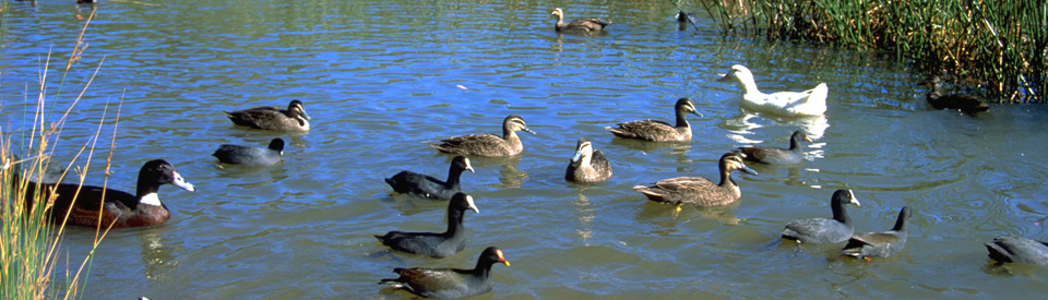
24. Lake Alexandra Reserve
Located on Queen Street, Lake Alexandra is a reserve characterised by plentiful birdlife and good picnic and barbecue facilities. The lagoon was originally constructed as a dam to supply water for the steam engines which hauled coal to the Mittagong ironworks. There is a number of pleasant walks from the lake to Mount Alexandra, Sixty Foot Falls and along Gibbergunyah Creek. The Visitor Information Centre has detailed maps and brochures. There is a good map at http://svc081.bookeasy.com/images/southernhighlands/Mount%20Alexandra%20Reserve.pdf which gives an idea of the range and variety of walks. Also check out http://www.weekendnotes.com/mount-alexandra-reserve-circuit-trail/ for a detailed description of the main walk.
36. St Paul's Presbyterian Church
Located on the corner of Edward and Alice Streets, St Paul's is a unique commentary on the mining families in the area. It was built in 1885 for the Scottish mining families who had arrived in the town to work in the shale mines at Joadja.
39. Victoria House
Located at 49 Main Street, this house, built by Henry E. Vaughan in 1860, was used at various times as a boy's boarding school and a doctor's surgery. It is currently Victoria House Needlecraft. For more information check out http://www.victoriahouseneedlecraft.com.au.
40. Fitz Roy Iron Works
Words fail me. Read the website at http://www.fitzroyironworks.com.au/ which notes that "The Fitz Roy Iron Works was the first iron works in Australia, which operated between 1848 to the 1890’s and established the industry in this country. The enterprise struggled to be successful over the subsequent decades, but assisted in establishing the iron industry in Australia. In July 2004, Woolworths Limited lodged a development application to build Highlands Marketplace Shopping Centre. In December 2004, the NSW Minister for Planning placed an Interim Heritage Order (IHO) on portions of the development site because of the site’s potential to contain remains of the former iron works. Highlands Marketplace opened in March 2007 with the Fitz Roy Iron Works restoration a key feature. The exposed remains of the protected site are located in the underground car park of Highlands Marketplace, 197 Old Hume Highway, Mittagong NSW. These remains have been conserved, maintained and displayed with permanent public access provided as part of the interpretation, communication and celebration of the history of the significant place." So the ruins are now in the shopping market car park. As I said: words fail me.
43. Fitzroy Inn and The Maltings
The Fitzroy Inn at 1 Ferguson Crescent was built in 1836 on the Old South Road which ran through the highlands to the plains around Goulburn. At the time the inn was in the heart of Mittagong. In 1867 the railway arrived from Picton, bypassed the existing town and established a station about 2 km further south. The township around Fitzroy Inn died and the inn closed in 1869. In 1871 it became Oaklands School and it was here, according to local folklore, that in 1875 the first tennis court in Australia was constructed. In turn the school closed, the building became a guest house until in 1972 it was converted into a private home. In 1989 it lovingly restored it. Today it is an attractive 4-star retreat. Check out http://fitzroyinn.com.au. Adjacent is Tooth's Maltings which was built in 1899. It was located in this prime position because the waters of the Nattai River could be used to manufacture barley malt for brewing. The plant closed after a fire in 1981.
44. Braemar and Prince Albert Inn
Located 3 km north of town on the old Hume Highway is the hamlet of Braemar where on the eastern side of the road there is a two-storey sandstock Georgian building with a stone-flagged veranda and 12 pane shuttered windows. This is the restored Prince Albert Hotel which was built in 1845. Over the road is Braemer Lodge (1876). Both buildings were built for Bartholomew Rush.
Other Attractions in the Area
Frensham and Sturt Craft Centre
Frensham is a remarkable and unique girls' school which was established in 1913 by Winifred West. It was named after the village of Frensham in Surrey where Winifred West had been born. When it opened in a 12-room house there were three students and five teachers. West was a remarkable educator. She created an environment for girls which had a special emphasis on drama, music, sports, arts and crafts. It is hardly surprising that Frensham girls are different and that over the years the school has produced an impressive list of notable Australian authors including Joan Phipson, Rosemary Dobson and Nancy Keesing. Winifred West, in keeping with her artistic bent, also set up the Sturt Craft Centre in 1941 as an outlet for local craftspeople. It features weaving, woodwork, metalwork, jewellery, textiles and pottery workshops, a gallery and a shop. Check out http://www.sturt.nsw.edu.au for "what's on". The Centre has an extensive program of exhibitions.
LiSun Mushroom Tunnel Tours
Located at 16 Davy Street, LiSun Exotic Mushrooms is owned by Dr. Noel Arrold who began breeding a range of exotic mushrooms in a disused 1866 railway tunnel in the early 90s. The range now includes Shiitake, Oyster, Shimeji, Chestnut, Nameko, Enoki, King Brown, Swiss Brown and Woodear. There are tours three or four times a year. Contact Claire Cooper at tel: 4871 2524 or http://www.highlandsfoodiegroup.com.au/ for times and details. And check out the story of LiSun at http://www.li-sunexoticmushrooms.com.au.
Mt Gibraltar: The Gib
Mt Gibraltar (863 m), known to the locals as 'The Gib', is located on the southern side of the town and has strong spiritual significance for the local Gundungurra people. It is the highest point between the Illawarra coast and the Great Dividing Range. In the 1890s it became important as a quarry with the local trachyte being used extensively on buildings including the Cape Byron Lighthouse, the National Library in Canberra and Australia House in London. The quarry was closed in 1980 after local protests.
There are four lookouts on Oxley Drive which traverses "The Gib". (i) The Bowral Lookout has views across Bowral (180 m below) with the Wingecarribee Dam, Moss Vale and the Cuckbundoon Range near Goulburn in the distance. (ii) Then there is Oxley View, overlooking the first European land grant in the area which was issued to explorer John Oxley in 1825 and which he named 'Wingecarribee'. (iii) Jellore Lookout faces west and north-west to Mount Jellore (a conical volcanic summit). In the distance are the Blue Mountains and (iv) the Mittagong Lookout faces north and north-east over Mittagong (240 m below) with Sydney visible on a clear day and Mount Keira, above Wollongong, to the east. The quarries on The Gib were listed on the State Heritage Register in 2013.
Hill Top and the Cave Creek Walking Track
Located 15 km north of Mittagong via Colo Vale is Hilltop. There is a pleasant 2.6 km walking track (it will take around 90 minutes) to Cave Creek which involves a steep descent, a ladder leading to a cave entrance, a rock shelf and a cave outlet. It can be accessed via Wilson Drive and there is a car park with picnic, barbecue and toilet facilities at the start of the walk. There is a very detailed map, complete with a description of the walk, available for download at http://121.50.208.46/southernhighlands/Cave%20Creek.pdf.
Box Vale Mine Walking Track and Lookout
Located on Box Vale Road off the Hume Highway, this interesting 4.4 km walk with easy grades (the return walk takes around 3 hours) follows an historic railway line and passes through an 84 m tunnel, cuttings and along embankments. There is a short track off the main track which leads to the Forty Foot Falls. A useful map is available at the Visitors Centre. Check out http://www.visitnsw.com/destinations/country-nsw/southern-highlands/mittagong/attractions/box-vale-mine-walking-track-and-lookout.
The Hermitage Winery and Cellar
Located at Old South Road, the Marist Brothers retreat and retirement estate, known as The Hermitage Winery and Cellar (http://www.thehermitage.org.au), has home made fig jam as well as locally made reds and whites. They have 13 hectares supporting a range of cool climate grapes including pinot noir, merlot, Riesling and pinot gris. They also produce chutneys and Angus Beef. The estate, which was purchased for the Marist Brothers by Dr Edwin Chisholm in 1905, is open to the public and a visit to the chapel, a sublime exercise in inspired modernism, is a reminder of the enduring artistic inspiration of religious iconography. The grounds – it is 155 hectares – are peaceful and particularly beautiful in spring and autumn.
Joadja
Today Joadja (for more detail check out https://www.aussietowns.com.au/town/joadja-nsw) is nothing more than a few remnants of buildings and a reminder of the transient nature of mining towns. The historic village/ghost town was established by the Australian Kerosene Oil and Mineral Company in the late 1870s to mine the vast kerosene shale deposits in the valley walls. It lasted until 1911 and has, for over a century, slowly decayed in the bush to the west of Mittagong. The remains of the old buildings can still be seen, including the miner's cottages , a schoolhouse, a church, a cemetery and shale ovens for the refinement of kerosene which have a World Heritage listing.
The shale was identified by Edward Carter who set up the mine in the valley. The shale was excavated and heated in brick retorts to draw off the kerosene which was then condensed and purified. Carter then sold the kerosene to the Australian Gas Light Company. Initially it was hard to get the produce to Sydney. It was hauled up the steep valley by bullock teams and then carted in five tonne wagon loads to Mittagong railway station. Later a narrow gauge railway was built. It connected the mine to Mittagong. For details of access to the site and weekend tours tel: (02) 4878 5129 or check out http://www.joadjatown.com.au.
^ TOPHistory
* Prior to European settlement the area around Berrima was occupied by the Dharawal (Tharawal) Aborigines.
* The first European to explore the area was John Wilson, an ex-convict, who led a party through the area in 1798. Their mission was to find out about the area so they could report to Governor Hunter who wanted to convince deluded Irish convicts that there was not a "New World" of white people living 200 miles south-west of Sydney. During the expedition Wilson shot a lyrebird and the group saw a "cullawine" (koala).
* In July, 1805 George Caley, a botanical collector for Joseph Banks and an explorer, travelled through the area collecting specimens.
* In 1814 Hamilton Hume and his brother John, probably in the company of their uncle John Kennedy, explored the area.
* One of the district's first settlers was the explorer John Oxley who, in 1815, drove a herd of cattle into the area and established a property near the site of modern Berrima.
* Charles Throsby, an explorer and later a major property owner in the area, travelled through the area a number of times between 1817-1819.
* The building of the Old South Road between 1819-1821 saw a road pass through Picton, Mittagong and Bong Bong to Sutton Forest and on to the Goulburn Plains.
* The first European settler in the district was William Charker who arrived in 1821. He grazed cattle and by 1823 he had received a grant of 200 acres.
* In 1827 George Cutler built the district's first inn, the Kangaroo Inn, on the Old South Road at Lower Mittagong.
* The explorer Charles Sturt lived in this area in the 1830s.
* By the 1830s, when the road through Mittagong to Berrima was completed, there were few people living in the area.
* In 1833 iron ore was discovered.
* By 1845 the population had grown. In this year two hotels were built. Ann Cutler built the Fitzroy Inn and Bartholomew Rush built the Prince Albert Hotel.
* Bushrangers frequented the thick scrub of the district from the 1830s to the 1870s.
* In 1842 John Lynch, who murdered ten people in the area between Razorback and Berrima, was hanged at Berrima.
* In 1848 a syndicate built Australia's first iron smelter - the Fitz Roy Iron Works - near the local iron and coal deposits. This produced a demand for skilled labour who emigrated from England. Many came from Sheffield, the famous steel-making town.
* Iron and steel had a chequered career in the town. The first venture failed and the plant was closed in 1857.
* Another iron foundry was started in 1863 but it was closed in 1866.
* The town's first post office was opened in 1862. The same year a school, run by Catholics, was opened.
* The town's first public school was opened in 1865
* The Methodist Church started to hold services in 1866.
* The railway reached the town in 1867. The station was known as Mittagong.
* Coal mining began in the 1870s.
* The post office officially changed its name to Mittagong in 1875.
* St Stephen's Anglican Church was consecrated in 1878.
* In 1883 the first bank was opened and the Mittagong Mail were established.
* The Nattai Coal Mining Company was established in 1883.
* Mittagong was declared a municipality in 1889.
* A large maltings plant was opened by Tooths Breweries in 1899.
* During World War II BHP mined iron ore in the district.
* In 1941 the Sturt Craft Centre, the first in Australia, was opened.
^ TOPVisitor Information
Southern Highlands Visitor Information Centre, 62-70 Main Street, Mittagong, tel: (02) 4871 2888.
^ TOPUseful Websites
There is an excellent guide to the town which can be downloaded at http://www.rahs.org.au/wp-content/uploads/2014/07/Mittagong-Self-Guided-Walk.pdf. There is also Visit NSW's comprehensive guide to local attractions at http://www.visitnsw.com/destinations/country-nsw/southern-highlands/mittagong/attractions.
^ TOP
Where was Loseby’s Inn located on Old South Road & Range Road, Mittagong in circa 1907? The Whatman family lived there when my grandfather James Clifford Whatman was
a little boy & his brother Hector is in a picture I have of them both under a tree taken by their
mother who has written on the back of the photo a description of where the photo is taken.
This was in my grandmothers possessions who passed away in 1984.