Quiet rural service town near Cania Gorge National Park
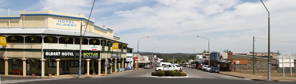
Monto is a small rural service centre inland from Bundaberg. It is a town dependent on the surrounding agriculture - predominantly mixed farming and timber. It is one of the newest towns in Queensland having come into existence as recently as 1924 when, under the Land Development Scheme, larger properties were resumed and prime agricultural land was provided, in smaller lots, to soldiers who had returned from World War I.
Location
Located 249 metres above sea level, Monto is 477 km north west from Brisbane via the Bruce and Burnett Highways.
^ TOPOrigin of Name
It is believed that "monto" is probably a Gureng Gureng Aboriginal word meaning "plains with ridges on them". In the same language "cania" probably means "spear".
^ TOPThings to See and Do
Monto Historical Complex
Located at 20 Flinders Street this is a typical historical complex with a wide range of historic artefacts and excellent exhibitions of memorabilia. The complex is open by appointment (you can wander around the outside exhibits - they are easily accessible). For more information contact Ann Green, tel: (07) 4167 2216.
A review of the complex noted: "The Monto Historical and Cultural Complex is a well-presented facility, with a pleasant garden frontage located on one of the main thoroughfares into Monto. The overall aim is to preserve and present the culture, heritage and history of the Monto district and its people. The complex includes a museum and art gallery housed in a modern, air-conditioned building. Half of the internal space is dedicated to changing cultural displays of photography, textiles, art and craft from local artists and societies. Historical displays, exhibits and photographs are located in the other half of the building.
"The historical collection extends beyond the main building into the grounds of the complex. A group of pioneer buildings include a Cania goldfields slab hut and the Goody family’s Birnam Homestead kitchen, which dates from around 1910. The slab hut and Birnam Homestead kitchen are original buildings relocated from surrounding rural properties. There’s a lot to see including an unusual timber jack honed from one log, an early railway carriage with historical railway memorabilia and the Cynthia station siding. Also featured is a remarkable array of horse-drawn vehicle replicas, built by Harold Ware, and a wheelwright’s workshop where visitors can watch demonstrations by Harold, an enthusiastic and highly skilled member of the Monto Historical Society."
One of the most interesting exhibits is a 1/5th replica of a World War II Liberator B24D Bomber nicknamed Beautiful Betsy which is located outside the main building. It was built in February 1943 in San Diego. "On 15 April 1943 she departed Hamilton Airfield California and arrived at Amberley Brisbane. Her first combat mission was 11 June 1943 on a bombing raid against Koepang Timor. In all she flew 22 combat missions before being retired as a cargo aircraft. Her final ill fated flight left Darwin on 26 February 1945 at 2200 hours bound for Eagle Farm airfield Brisbane. Two days later two B24s flew the route focusing on the Claraville area where the bomber was last reported at 3.00 am but failed to find any trace of the aircraft. The crash site was located on 2 August 1994 in Kroombit Tops National Park north of Monto. US and Australian army personnel visited the site during 1994 and recovered various remains and personal effects. The cew was officially declared dead on the day of the mission. American crew members were memorialised on the tablets of the missing at Manila American Cemetery. Afer the recovery of remains in 1994, McDaniel, Tucker, Owen, Lemons, Cook and Cannon were buried at Arlington National Cemetery on 25 September 1995."
Check out http://www.magsq.com.au/_dbase_upl/Monto%20Profile.pdf for more information about the complex.
Ken Russell Memorial in Lions Park
Further along Flinders Street is the LIons Park which includes a bronze statue of local jockey Ken Russell. Russell was born in Monto and between 1972 and 1993 he raced in Queensland, New South Wales, Victoria, Singapore, Macau, Malaysia, Dubai, Mauritius and Abu Dhabi. He was only 42 when tragically killed in a race fall at Rose Hill in 1993.
Lister Street Parkland and Art Walk
At the bottom of the town's main street there is a narrow park, the Lister Street Parkland, which has an art walk through landscaped parkland. There is an impressive small timber bridge but the main focus is on a sandstone and iron sculptures including Eucalypts by Sonya Murr (2002) and Moonlight by Christopher Calcutt (2008).
Monto Town Hall
At the top of Newton Street is the impressive Monto Town Hall which was built in 1939-40 by Hall and Phillips Architects. Hall was one of Brisbane’s most successful architects of the early 20th century. He also designed the Brisbane City Hall, Tattersall’s Club and Sandgate Town Hall. The building is an interesting example of the then-fashionable Art Deco style.
Other Attractions in the Area
Cania Gorge National Park
The Queensland Department of National Parks notes that Cania Gorge National Park "preserves a valuable remnant of the Brigalow Belt natural region. More than 150 different types of plant community are found in this region, including brigalow forest, eucalypt woodland, cypress pine woodland, dry rainforest and grassland. The park is home to more than 90 species of bird. Brush-tailed rock wallabies and common bent-wing bats are also seen. Aboriginal people lived in Cania Gorge for at least 19,000 years. Freehand art on the sandstone walls is a reminder of their special way of life."
The sign at the entrance to the park explains: "Sixty five million years ago Cania Gorge did not exist. Instead this area was covered by many layers of sandstone which formed on the bottom of an ancient lake during the Jurassic Period 160-190 million years ago. After the lake dried up forces under the earth's crust tilted the exposed sandstone layers slightly and caused them to crack so that run-off from rainwater began to seep southward along a fault line. For 65 million years this water flow eroded the sandstone. Eventually the winding bed of Three Moon Creek and the wide gorge we see today were formed.
"Side gullys and creeks provide moist, cool conditions suitable for ferns, mosses and rainforest plants. In contrast, the open woodland of tough eucalypts on the exposed plateau above the cliffs is dry and often hot. Fringing the base of the cliffs and extending down drainage lines is the rich green of vine thicket vegetation ... the park's 3000 hectares provide important habitat for a range of wildlife. Over 130 species of birds have been recorded here including waterfowl, doves and pigeons, parrots, cuckoos, flycatchers and honeyeaters ... also whiptail wallabies, brush-tailed rock-wallabies, koalas, echidnas and lace monitors."
To access the park follow the Burnett Highway from Monto in the direction of Biloela. After 12 km take the sign posted turnoff on the right onto a bitumen road that passes through Moonford. It is 14 km from the highway to the park entrance. This bitumen road passes a privately run caravan/camping area and continues through the Park, past a carpark from where the walking tracks depart. Not far beyond this is a turnoff from the main road which leads to another parking area - the start of a walk to the Shamrock mine site. The main road continues north until it reaches the shores of Lake Cania which lie outside the Park.
Walking in the Park
There are eight walking tracks in the Park all of which are described in great detail at http://www.nprsr.qld.gov.au/parks/cania-gorge/about.html.
1. Picnic area circuit - 300 m return (20 minutes). This short walk runs beside Three Moon Creek, allowing views of the sandstone cliffs across the creek and surrounding eucalypt woodland. It can be accessed from either end of the car park.
2. Dripping Rock and The Overhang - 3.2 km return (2 hours 20 minutes). This pleasant walk starts at the southern end of the picnic area. After crossing the Three Moon Creek the track winds through open eucalypt woodland with tree ferns and piccabeen palms before leading to the base of Dripping Rock (2.2 km return) where a boardwalk protects ferns and mosses. The track continues past weathered sandstone to The Overhang, where water has eroded the base of the sandstone cliff. There is a pool in Russell Gully.
3. Dragon Cave and Bloodwood Cave - 2.6 km return (60 minutes). If you walk for 400 metres along the Dripping Rock track there is a right turn over a bridge across Russell Gully. A track leads to the cliff face covered with silver elkhorns, where a sidetrack branches north to Dragon Cave (1.8 km return). Here, the natural black stain "mural" of a 'dragon' can be seen highlighted against the white sandstone wall. The southern branch of the track leads to Bloodwood Cave, so called because the roots of a bloodwood tree can be seen at the side of the cave.
4. Two Storey Cave circuit - 1.3 km return (45 minutes). This walk starts over the road from the picnic area. It is a circuit which meanders upwards around isolated sandstone monoliths. A 20 metre sidetrack leads to King Orchid Crevice, a parting of the cliff that has created an ideal haven for epiphytes - notably king orchids and silver elkhorns The Two Storey Cave is important habitat for the common bent-winged bats which should not be disturbed during daylight hours.
5. Fern Tree Pool and Giant's Chair circuit - 5.6 km return (3 hours) - The circuit begins from a car park 900 m south of the first picnic area. The path passes through both eucalypt and vine forest and crosses Doctors Gully several times, reaches Fern Tree Pool (2.5 km) - which is unsuitable for drinking - and continues for 2.2 km up a sandstone escarpment to the Giant's Chair lookout. The circuit returns to the car park down a steep track and steps.
6. Big Foot walk - 1 km return (20 minutes). This short trail begins at the Fern Tree Pool park and runs parallel to the road. It features a large brown stain of a four-toed foot (the "Big Foot"?) on the white sandstone cliff.
7. Shamrock mine site - 1.4 km return (45 minutes). This walk begins from the northern car park, about 1 km south of Lake Cania. The track moves along a creek before passing into eucalypt woodland. At the former Shamrock gold mine site, there is a self-guided walk with information about life on the Cania Goldfields. The remains of the old battery, mine shafts, processing sheds and mullock heaps can be seen.
8. Castle Mountain - 22 km return (7-8 hours). From the picnic area follow the 800 metre Bloodwood Cave track to the Castle Mountain track turn-off. There is a steep 200 m track to the Gorge Lookout with an impressive view down the gorge. From here a 10 km fire trail winds through open woodland to Castle Mountain lookout. The route then returns along the same tracks.
Lake Cania/Cania Dam
The road through the National Park continues until it reaches Cania Dam which covers 630 hectares. The 88,500 megalitres of water are held back by a dam wall 340 metres long and 47 metres high. There are points where the cliffs of the area tower dramatically above the dam. The highlight of any visit to the dam is the 3.9 km (return) climb to Castle Mountain from the Cania Dam wall. The walk offers superb views over the dam and the surrounding mountains. Weathering has carved caves and holes into the sandstone of Castle Mountain and there is a prominent feature known as the 'elephant's head'. The dam is ideal for fishing, sailing, water skiing, canoeing, wind surfing and the shores have good picnic and barbecue facilities. Anglers can expect catches of saratoga, bass, golden perch, silver perch, eel-tailed catfish, spangled perch and snub-nosed garfish.
Mulgildie and the Bunyip
Located 16 km south of Monto, Mulgildie is a non-town with a famous sculpture - the Mulgildie Bunyip. Created by artist Brett Benecke to celebrate 80 years of service from the Mulgildie branch of the Country Women's Association it "relates to the many and varied legends of the Bunyip Hole. The artist has used plate steel that has been through a forge and been shaped to depict the scales. The Bunyip is carrying his typical lunch, in relation to the legend of the area." The sculpture was unveiled in 2010. Nearby is a sign explaining how to get to the Bunyip Hole and there is a brass plaque explaining that "Aboriginals tell the story of fearsome booming monsters that inhabit swamps and waterholes. Just ten minutes from the tranquil township of Mulgildie lies the legendary Bunyip Hole; a place of mystery and intrigue. Over the years, tales have emerged of strange noises, bubbling, churning water in the hole and of cattle disappearing into the depths as they drank. Known as 'Devil Devil' country, Aboriginal tribes and drovers too, could not be persuaded to camp near the Bunyip Holes. Some Aboriginal Elders believe the Bunyip Hole is connected to a vast network of underground caverns passing Tellebang Mountain and stretching as far as Ban Ban Springs. The mystery of the Bunyip Hole may never be known."
History
* Prior to the arrival of Europeans the area around Monto was home to people from the Gureng Gureng Aboriginal language group.
* In 1848 Thomas Archer (one of the seven Archer brothers who did so much to open up Central Queensland) explored the area from his property at Cooyar.
* Later in 1848, with his brother Charles, Thomas Archer moved sheep into the area.
* By the late 1840s Adolphus Henry Trevethan had settled on Rawbelle Station which spread over 1000 square miles.
* The area consisted mostly of large pastoral holdings until the 1870s.
* Gold was discovered in 1871 causing a rush to the Cania field, though yields were intermittent.
* The population rose to 252.
* By 1876 the "town" had a population of four people.
* Around the 1870s the district became infested with speargrass which resulted in sheep being replaced by cattle.
* Mining continued throughout the 1880s, with one reef yielding 2,395 ounces.
* Mining finally ended in the early 1900s.
* The real change in the area came after 1919 when a Royal Commission was set up to investigate the possibility of closer settlement in the northern Burnett River region.
* By October 1923 the Government had received 1773 applications for land in the Monto area.
* 1.4 million acres of the large properties were resumed by the Queensland government and the town of Monto was established in 1924.
* Monto was the first town in Queensland to be designed under town planning techniques and it was gazetted in 1924.
* In 1925 a post office was built.
* In 1926 the state government designed Monto as a "garden city".
* In 1928 the railway connected the district to Maryborough.
* 1929 saw the establishment of the Port Curtis Dairying Company.
* By 1930 a connecting railway line had been built through to Gladstone.
* The Monto Shire Council was established in 1932.
* Reticulated water reached the town in 1956.
* Sewerage was connected in 1968.
^ TOPVisitor Information
Monto Visitor Information Centre, Lister Street, Monto, tel: 1300 696 272.
^ TOPUseful Websites
There is a useful website which deals with towns in the North Burnett. Check out http://northburnett.org/destinations/monto.
^ TOP
I have a question. I had a pen pal in the 1970s called Gaye Swansbra. She lived on a farm near Monto called “El KargeM2 I guess. Does it still exist? Cannot find it.
No sheep near Monto and not much left of the timber industry. Beef, yes.
the name c a n i a is black fella name not a white fella name ,no need to worry about i before e ,i or a before any thing CANIA is pronounced K nee a , not CAN E A,.go back to school and start again, and listen this time
Hi, Im am just looking for Dawn McFadden that came from Monto many years ago
Good afternoon I will b in Monto, where I was born nearly 86 years ago,my sister will be with me born there 84 years ago
Among first pupils at Monto Catholic school 1941
Grand children of Thomas Valentine Malone born Co Clare Ireland 1866
Been to Ireland quite a number o times, so have a lot of Family history as always close ties kept even when the mail took 3 months
Will be in Monto on Monday 27th July and would love to visit the Centre
Best regards Rita Malone JP QUAL
My dad left many years ago to see a man about a dog. We believe he may have gone to Monto as I hear many good dogs come from there. Has anyone seen him. His name is Bruce.
Loved this about my birth place.
In the not too distant future I will be desiring a 2 bedroom unit or small house to rent for 2 middle aged ladies with one well behaved house trained desexed male cat aged 10 years. If you can direct me to the appropriate persons please can you help. Thanks