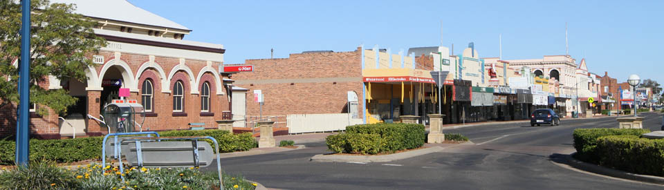
Major town on the Newell Highway and Namoi River.
Narrabri is the administrative centre of Narrabri Shire which is located in the Namoi Valley. The rugged peaks of Mount Kaputar National Park loom to the east while plains stretch endlessly to the west. The shire is known as an agricultural wonderland. It produces high quality wheat, fat lambs, beef and cotton. The town is located at the junction of the Newell and Kamilaroi Highways and is named after the Kamilaroi word for 'forked waters' which is particularly apt as the Namoi River, Narrabri Creek and the Horse Arm Creek all converge at the town.
Location
Narrabri is located 525 km north-west of Sydney via Muswellbrook. It is 240 m above sea-level.
^ TOPOrigin of Name
It is accepted that "narrabri" means "forked waters" in the language of the Kamilaroi Aborigines. This is sensible given that the town is located where the Namoi River, Narrabri Creek and the Horse Arm Creek all converge.
^ TOPThings to See and Do
The Narrabri Historical Creek Walk lists 14 places of interest in a short walk around the banks of Narrabri Creek. It can be downloaded at http://www.visitnarrabri.com.au/wp-content/uploads/2015/09/Narrabri-Historical-Walk_lores.pdf
Narrabri Historical - Creek Walk
Starting at the Visitor Information Centre on Tibbereena Street, this short walk passes the Major Mitchell Plaque and the Crossing Theatre then follows the bank of the creek past the town's Sports Fields, Collins Park, the cricket sight boards which were moved from the Sydney Cricket Ground, the Cade Memorial Gates, the Olympic Swimming Pool, then around the river banks to the Creek Bridge, the Town Clock and back to the Australian Cotton Experience Centre which is located beside the Visitor Centre.
Of particular interest on the Creek Walk is the:
10. Olympic Swimming Pool
In 1910 a swimming club was formed and Council gave permission for baths to be erected on the Creek at a site near Narrabri Creek Bridge. Amusingly, given the strange morality of the time, the pool was male only. The women formed their own club in 1911 and swam at a sandy spot further downstream. The current pool was opened by Olympic gold medallist and world record breaker Lorraine Crapp in 1958. The new indoor aquatic centre was opened in 2012.
Narrabri Historical - Town Walk
The Narrabri Historical Town Walk lists a total of 44 places of interest in Narrabri. It can be downloaded at http://www.visitnarrabri.com.au/wp-content/uploads/2015/09/Narrabri-Historical-Walk_lores.pdf . The most interesting places include:
5. Krohns Shoe Store
Located on the corner of Doyle and Maitland Streets, and now known as Stilettoz, this beautiful building is a history of the town's frequent fires. It was originally built as a family home in 1875 by Mr. Theodore Morath, who leased it to the ANZ Bank. The building was destroyed in the great fire of 1905 and replaced by a two storey structure in 1907, built for stock and station agent Mr TA Stirton. The building housed the Government Savings Bank and Narrabri Pastures Protection Board until purchased by Mr W Krohn for a shoe store in 1912. The building was burnt down for a second time in 1923 and replaced by the current building in 1924. It is the only building in Maitland Street to retain its original verandas.
19. Old Police Residence
It stands out in the street because, back in 1977, it was restored at a cost of $48,000. Originally built in 1880 it was the Police Sergeant’s residence and later became the Lock Up Keeper’s residence. The residence elegantly complements the Court House and Clerk of Petty Sessions.
20. Court House
Now almost hidden from Maitland Street by mature trees, the substantial and gracious Court House was designed in the office of Colonial Architect, James Barnet, and built in 1888 to replace the original Court House which still stands next door. According to the records at least half a dozen sheep and cattle stealers were dealt with each court day. Alterations in 1910 added two jury rooms and jury yards. A further room was added for the Crown Prosecutor in 1962.
21. Clerk of Petty Sessions
Located next to the Court House and around the corner from the Old Gaol, the Clerk of Petty Sessions building was completed in 1865 to plans drawn up by Colonial Architect, James Barnet. It is protected under a heritage listing as part of the Court House complex.
22. Narrabri Old Gaol Heritage Centre Museum
Located at 2 Bowen Street and designed by Colonial Architect, James Barnet, the old gaol was built by J. Conlan for £3,590/8/6 and housed prisoners from September 1882 through to September 1982. The building comprised an office, charge room, medical room, seven cells for men and one cell for women. The Narrabri & District Historical Society now houses its collection in the building. It opened the Museum to the public in 1988. One cell has been left as it was in 1988. Other cells feature exhibitions which include women's clothing from 1900; medical apparatus; a collection of war memorabilia; a dairy section; a history of the Dalway family (a prominent local family); and a parlour as it would have been between the wars. The centre is open from 9.00 am to 1.00 pm on Saturday and 10.00 am - 2.00 pm on Wednesday. For bookings at other times contact the Narrabri Visitor Information Centre, tel: (02) 6799 6760.
24. Gallipoli House
Located over the road from the Old Gaol, Gallipoli House was originally the Namoi Steam Flour Mill. It was constructed in 1881 and was purchased in 1899 by, A.R. Stafford who generated electricity from the mill and supplied electricity for many years to his business interests. The flour mill moved in 1912. It was once used as the RSL Club, hence the name ‘Gallipoli House’.
27. Tattersalls Hotel
Another case of a hotel burning down. It was originally known as the Grand Central Hotel and was built in 1882. It was rebuilt in 1912.
31. Westpac Bank
Prominently located in Maitland Street, the former Bank of New South Wales, was severely damaged in the fire of 1917, which destroyed all the buildings in the block down to the Post Office. The bank was reconstructed in 1918 and has an elegance in keeping with the importance of a bank in a town surrounded by a district of prosperous farmers.
33. Post Office
Located on the corner in the main street this evolving public building was originally constructed by contractor Mr. T. Avery and opened in 1879. In 1888, four arches were added. Repairs were carried out following a cyclone in 1900, one room was added for telephone equipment. Extra rooms were added in 1910. In 1916 two more arches were added and the entrance was rebuilt in 1955.
Narrabri Lake
Located at the south-western end of town this charming and surprising stretch of water is an ideal spot for picnics and there is a pleasant walk around the shoreline. The lake is home to a variety of waterbirds including black swans, ibis and pelicans.
Other Attractions in the Area
Sawn Rocks
One of the natural highlights of the area is the remarkable volcanic formation known as Sawn Rocks. It is generally accepted that the formation, a 40 metre high basalt cliff face featuring perpendicular-octagonal shaped rocks resembling a giant series of organ pipes, was formed by a rare volcanic action which resulted in the rapid cooling of the upper layers of molton rock following volcanic activity which occurred 21 million years ago. It consists of a series of precisely geometric forms that appear to be the product of a chisel rather than natural forces.
The feature is easily accessible. Drive 3 km north of Narrabri on the Newell Highway. A sign pointing to the right indicates Bingara Road and the Sawn Rocks are 36 km along that road. The National Parks have covered themselves with glory. The car park is spacious. The signage is informative and the walking track, which is 750 metres long, is flat and sealed. It is a 10 minute stroll, through tall eucalypts, Morton Bay figs, wattles and many varieties of delicate ferns. There is a viewing platform directly opposite the main feature and it is possible to walk down steps to Bobbiwaa Creek. Amongst the clear rock pools at the base of the formation, the rock has fractured into octagonal shapes identical to the cliff face. It is believed that these plunge a further 60 metres into the earth below. There is an excellent downloadable brochure. Check out https://www.nationalparks.nsw.gov.au/things-to-do/walking-tracks/sawn-rocks-walking-track.
Waa Gorge
Located 62 km along Bingara Road, Mellburra Road and Allambie Road is the Waa Gorge (pronounced "war") and the Waa Gorge carpark. Most of the drive is on a dirt, dry-weather road. There is a 1.25 km track (2.5 km return, hard, estimated time 2 hours 30 minutes) which leads from the car park, past the picnic area, to the 'Devil's Waterholes', two deep pools in which you can swim. Climb the small hill on their left and follow the track alongside the creek. The walls of the gorge are bright orange and the area is ideal for a quiet picnic. Check out http://www.nationalparks.nsw.gov.au/things-to-do/Walking-tracks/Waa-Gorge-walking-track.
Rocky Creek
Located 54 km north-east along the road to Bingara is Rocky Creek Gorge and 'Glacial Area' . It is a picturesque site where glaciation took place some 290 million years ago during the Carboniferous Period. If you look at the landscape around the creek carefully you will notice it is made up of many different sizes and types of stones, all cemented together in a matrix of finer gravels, sand and clay. It is a fluvio-glacial conglomerate formed when the material carried by the glacier was deposited as the glacier retreated. The pools are ideal for swimming and the area has limited camping and picnic facilities. There is a more detailed information leaflet available at the Visitor Information Centre in Bingara. Check out http://www.visitnarrabri.com.au/index.cfm?page_id=1054&page_name=rocky%20creek%20glacial%20area.
Mount Kaputar National Park
Located 52 km east of Narrabri via Mt Kaputar Road the Mount Kaputar National Park is a remnant of an active volcano in the Nandewar Ranges. There was, between 17-21 million years ago, an arc of volcanoes which included the Warrumbungles and Mount Canobolas. There are two camping areas and a number of walking tracks in the park. The Bark Hut camping area, 48 km from Narrabri, has a camping and amenities block. 5 km further on is Dawson Springs campsite which is 1373 m above sea-level and which has an amenities block and two cabins. The park has a dozen walking tracks. The access road, although unsealed, reaches the summit of Mount Kaputar which is 1524 m above sea-level. It offers panoramic views and on a clear day it is possible to see up to 150 km in all directions. The park protects a wide variety of plant communities including semi-arid woodlands, wet eucalypt forests and sub alpine heaths. it also has a host of animal species and provides a haven for many threatened species including bats, birds, wallabies, qualls and the unique large pink slug. Check out http://www.nationalparks.nsw.gov.au/visit-a-park/parks/Mount-Kaputar-National-Park for more information. There is also a useful brochure - http://www.visitnarrabri.com.au/files/uploaded/file/Mount%20Kaputar%2007.pdf.
Australia Telescope
Located 23 km from Narrabri, the Australia Telescope is one of the "must see" places in the district. In 1967 the CSIRO established a radio helioscope at Culgoora and by the 1980s the Australia Telescope had been built. It was linked to the telescopes at Coonabarabran, Parkes and Tidbinbilla. The Australia Telescope is the most powerful in the Southern Hemisphere. It receives radio waves from deep space by means of six gigantic dishes which are placed on a rail track so they can be moved and adjusted. The telescope is located 20 km south-east of Wee Waa with access via the Old Pilliga Road. Visitors are welcome. The telescope is open seven days a week and admission is free. There are interactive “hands on” displays and the “Whispering Dishes” creates an audio effect where the merest whisper can be transmitted over one hundred metres by aligning two small telescope dishes. The telescope is the only one in the southern hemisphere capable of receiving signals one thousand times higher in frequency than FM radio stations. The "self guiding" new display's are open every day 8.00 am to 4.00 pm. It is a superb display which is both impressive and hugely informative. The visit is definitely worth the effort.
Yarrie Lake
Located 8 km south-west of the Australia telescope complex is Yarrie Lake, a large pool of water (1.6 km in diameter) on the boundary of the Pilliga Scrub. It is believed by some to have been formed by a falling meteor. It is a haven for water birds with over 70 species being observed including birds which have migrated from as far north as Russia. The lake has a distinct milky colour which probably comes from the sand and soil of the surrounding creeks. The lake is ideal for camping, swimming, sailing, waterskiing and other water sports.
Pilliga
Located 99 km west of Narrabri is the tiny township of Pilliga. Pilliga was once an important stop on the Cobb & Co route. Those days are recalled by the hitching rails outside the stores which are still used by local stockmen. It has a hot artesian bore bath in a tiled pool. The water temperature is 37°C. The bore was sunk in 1902 and the original flow was 1.25 million gallons a day. In recent times the flow has been reduced. The waters are recognised for their therapeutic values. The Pilliga Cemetery is located on the road out to Coonamble. It is worth pausing because, unusual for an Australian country town, it has the graves and headstones of the Allum family who were Indian hawkers who travelled through the western area in the 1880s. They are clearly marked on the downloadable map at https://www.nationalparks.nsw.gov.au/visit-a-park/parks/pilliga-national-park.
Pilliga Scrub
Located south of Pilliga is the Pilliga Scrub or Pilliga Forest which cover 500,000 ha. It is a vast woodland area which was lightly timbered before the arrival of Europeans. Heavy grazing on poor soils encouraged the growth of thick Australian timber, including the largest cypress pine forest in the Southern Hemisphere. This development gave birth to an active timber industry. Today the Forest has 300 animal species and over 900 plant species. The scrub is superb in spring when the wildflowers are in bloom and significant colonies of koalas are sleeping in the trees. The dirt roads are strictly dry-weather-only. There are 2,700 km of tracks criss crossing the scrub and heading for camping spots and bushwalking trails. A timber industry existed in the forest until 2005 when it was scaled back by the New South Wales Government. Today it borders on viabillity and there is still extensive cutting of the native cypress pine which regenerated in the 1950s. All sources advise purchase of a good map which is available from National Parks and Wildlife of the Visitor Centre in Narrabri.
Pilliga Sandstone Caves
Located 83 km south of Narrabri on the Newell Highway, the Sandstone Caves are located in the Pilliga Nature Reserve. These caves are formed by the actions of wind and water on cliffs of soft sandstone. The Pilliga Nature Reserve consists of open forests and woodlands dominated by Eucalyptus, Angophora and Callitris Trees, Brown Bloodwood, Black pine and narrow-leaved Ironbark. It provides a habitat for a range of threatened species including Mallee fowl, Pilliga Mouse, Swift Parrot, Regent Honeyeater and Black Striped Wallaby. There is a pleasant picnic area and a medium difficulty 1.7 km return track around the hill where there are a number of caves with evidence of Aboriginal habitation including grinding marks and artwork in the sandstone.
Bellata
Located 45 km north of Narrabri is the small village of Bellata which is known as an excellent place for fossickers looking for agate, jasper, carnelian, petrified opal and petrified wood. For further information talk to the people at the Narrabri Visitor Information Centre.
Cotton in the Area
There used to be a time when inspections of the local cotton gins, during the harvesting and processing times, were popular with visitors to the area. This all stopped some years ago - partly due to the tightening of insurance and occupational health and safety issues - so that today it is not possible to inspect the cotton gins. In fact the Narrabri Visitor Information Centre was originally the "Australian Cotton Centre - It was a $2 million exhibition centre showcasing Australia's cotton industry in ways that utilise up-to-date entertainment technology to provide what is essentially an educational experience designed for the enjoyment of all ages. Within are nine interactive exhibits designed and built by Questacon - the National Science and Technology Centre in Canberra. A major exhibit is the 3D Theatre. One to two hours should be set aside and the needs of school and university groups of all ages are especially catered to. Cotton products and souvenirs are also available for sale." Today it has nearly all disappeared and there is a single machine, a few small exhibits and that is all that is left of a once very impressive exhibition. The other huge change is the way the cotton is collected. It used to be placed into huge trucks and it would, inevitably, spray out on the way to the gin leaving roads in the area looking as though they had experienced a heavy snowfall. One of the local clubs was enterprising enough to collect the fallen cotton, clean it and sell it to the gins for money which they used for charitable purposes. The new machines are so efficient they turn the cotton into plastic covered bales and very little is left beside the road. The local crops are planted in September and picked in April-May. Driving through the area at this time, particularly if it has been a good season, is a reminder of the importance of cotton to the local economy. In the Narrabri Shire a total of 54,169 ha are used to produce cotton. There are 151 producers and the value of their crops in recent times has been around $200 million. There is a small booklet, Pocket Guide to Cotton, available at the Narrabri Visitor Information Centre which, because it is produced by Cotton Australia, is full of information about how wonderful cotton is.
History
* Prior to European settlement the area was occupied by the Kamilaroi Aboriginal people.
* The explorer John Oxley became the first European to reach the area. In 1818 he noted the 'majestic' Nandewar Ranges from about 70 km to the south.
* The explorer Allan Cunningham explored the Boggabri Plains in 1825.
* It is known that escaped convict George Clarke roamed through the area from 1826-1831 and was accepted by the Kamilaroi people.
* Allan Cunningham's positive account of the Namoi River prompted the authorities in Sydney to send Thomas Mitchell on an expedition into the district in 1832.
* In 1834 'Nurrabry', the first squatting run in the district, was taken up.
* In 1848 a town site was recommended at the junction of the roads from the south and west.
* The first hotel was licensed in 1858.
* The town was formally proclaimed in 1860.
* A post office and police station were established but a flood devastated the township in 1864.
* The court and legal services were transferred from Wee Waa in 1864-65.
* A coach service to and from the town commenced in 1865.
* The first public school opened in 1868.
* In 1871 the town's population was 313.
* Wheat-growing began in the district in 1873.
* A bridge was built over the Narrabri Creek in 1877. Two years later a bridge was built over the Namoi River.
* A handsome police residence was built in 1880.
* The railway arrived at Narrabri West in 1882 and a settlement began to develop around it. That same year the Old Gaol began incarcerating prisoners.
* Narrabri was declared a municipality in 1883.
* The local Court House was built in 1888.
* The population of the town had reached 1,977 by 1891.
* In 1897 a fire destroyed 23 businesses in Maitland Street.
* In 1906 17 buildings in the centre of town were destroyed by fire.
* A soldier resettlement scheme was implemented 24 km north of the town after World War II.
* A major flood in 1955 devastated the town but Narrabri West was unaffected and so resumed something of its earlier importance. It was incorporated into Narrabri in 1981.
* In 1958 an Olympic swimming pool was opened.
* Cotton was introduced in 1962. Intensive research and improved irrigation led to the district having the largest cotton yields in Australia.
* A Tourism Centre made from cypress pine from the Pillaga Forest was opened in 1986. It currently stands next to the Visitor Centre
* In 1990 the cricket sight boards from the Sydney Cricket Ground were installed at Collins Park.
* In 2001 Channel 9 judged Narrabri the most sporting district in Australia with over 110 local citizens having represented their country in a variety of sports.
* In 2002 the Crossing Theatre, an $8 million complex, was opened.
^ TOPVisitor Information
Narrabri Shire Visitor Information Centre, Newell Highway, Narrabri, is open from 9.00 am to 5.00 pm weekdays, and 9.00 am to 2.00 pm on weekends and public holidays, tel: (02) 6799 6760.
^ TOPUseful Websites
The town has its own website which has information on food, wine and accommodation in the district. Check out http://www.visitnarrabri.com.au. There is also the excellent http://www.narrabri.net which has lots of additional information.
^ TOP
Hi there! The links in the above with “predelegation” in the URL are not (or no longer) valid – you get a domain sales site now. Thanks for the great app nonetheless!
My grandfather was born in Narrabri in 1912 – June 24. His parents were Sidney and Maude Ransley. Do you know what they did?
Apparently.. we are now going to Narrabri!