Significant and prosperous wheatbelt town
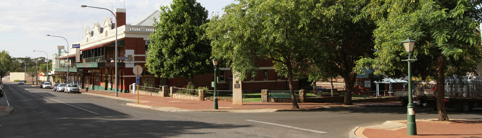
By the standards of the Western Australian wheatbelt, Narrogin is a substantial rural centre with a range of services and the offices of the Shire of Narrogin. The town's size was determined by its location at an important road and rail junction. Today it is a pleasant, prosperous wheatbelt town with parks and historic buildings. The primary attractions in the area are bushwalks in Foxes Lair Nature Park and the remarkable nocturnal tours in the Dryandra National Park where endangered native animals - dalgyte, woylie, wurrup, quenda and boodie - can be seen. Albert Facey, the author of A Fortunate Life who lived near Wickepin has a description of Narrogin around 1908 which still seems appropriate today. "Narrogin was one of the largest towns on the fringe of the wheatbelt. It had two hotels, two boarding-houses, two shops, a doctor, a chemist and a small hospital on a hill away from the railway station. It was on the Great Southern railway line and a train went through once a day each way from Perth to Albany."
Location
Narrogin is located 193 km south east of Perth and 192 m above sea level.
^ TOPOrigin of Name
Like most of the wheatbelt towns there is some dispute over the origins of the town's name. The popular interpretation is that it is a local First Nations word, "gnargijin" meaning "the place of water" or "a pool". This was first recorded in 1869. Other possible interpretations are "bat camp" and "plenty of everything". Part of the problem is that no one knows how to spell the name and it has been variously spelt as 'gngrgagin', 'nagacan', 'naroging' and 'ngnarajin'.
^ TOPThings to See and Do
Dryandra Country Visitor Centre
The Dryandra Country Visitor Centre is located at the refurbished railway station. Access is by an overhead bridge from the town side (Park St) with steps, or from the far side on Pioneer Drive, with ample car parking space on both access points.. It has information and displays on the region, including plants and wildlife. There is a wide range of free brochures and maps, including a series of useful biodiversity guides. The centre has free WIFI, photocopying, fax facilities, and a lounge area.
Narrogin Centenary Pathway
The Narrogin Centenary Pathway brochure (available at the Visitor Centre) allows the visitor to learn about the town from 100 black granite tiles which not only record the history of specific buildings but also recount specific events (e.g. Dawn Fraser broke the local 55 yards women's freestyle record in the local pool on 22 March, 1959). Narrogin has a number of interesting buildings in the centre of town, all which are worth investigating.
Narrogin Park
Narrogin Park runs between Pioneer Drive (the Great Southern Highway) and Hartoge Street. There is a delightful 1.5km heritage trail through the park with 100 black granite tiles depicting local historic events and offering an overview of life in the district. The trail starts at the parking area.
Railway Dam
The Railway Dam lies at the edge of Narrogin and can be accessed from the Car Park off Mokine Road. There are two walks from the Car Park: the Dam Walk (650 metres, 15 minutes) through shady flooded gum around the eastern edge of the dam wall. And the Archibald Park Walk (1200 metres - 40 minutes) - a longer, and equally pleasant, walk around the dam which is ideal for wildflowers in spring and the bird life which is attracted to the dam. The dam is also home to piebald tortoises. The dam was built in 1912 to meet the need for water from the steam trains which passed through the town. The Dryandra Country Visitor Centre in Narrogin has a very useful brochure complete with a map.
The Old Court House
The Old Courthouse, located on the corner of Egerton and Earl Streets, was originally built as a Government school in 1894. Designed by the prominent architect George Temple-Poole it remained a school until 1905 when it was converted into the local courthouse. It became the local branch of the Agricultural Bank between 1924 - 1945 but returned to a courthouse in 1970. It has been a museum since 1976 and contains extensive displays of local memorabilia which offer an insight into early life in the area. The museum is open Monday to Friday from 10.00 am - 4.00 pm and Saturdays from 10.00 am - noon. Tel: (08) 9881 6758.
Town Hall and Library
The Town Hall and Library (both built in 1908) are located on the corner of Federal and Fortune Streets. A smaller hall was added in 1928. It is a two storey building in the Federation Free Classical style and dominates the town's main street. It is a comment on the status of Narrogin at the time. It was an important regional centre. For more information check out http://inherit.stateheritage.wa.gov.au/Public/Inventory/Details/f9757979-2d95-4893-84f7-9e231d2338af.
Narrogin War Memorial
Located in the park off Williams Road, this remarkable and original war memorial "is a pavilion with neo-classic pillars and tile roof with paved walkway on the eastern approach. A monument stands in the centre of the pavilion with three sides having honour rolls which commemorate those who died in service or were killed in action in World Wars One and Two. The plaque to those who died in service or were killed in action in World War Two was added to the south side of the plinth in 1953. It was completed at a cost of £325.00. The brass name plates of men who had served in World War One were attached with screws to two large jarrah tablets, which were covered with plate glass and attached one each side of the entrance at the eastern end of the pavilion. The name plates were designed so that in the future they could be rearranged or added to, as in 1923 the authorities were still unsure if all names had been collected." This information comes from the excellent Monument Australia website. Check out http://monumentaustralia.org.au/themes/conflict/multiple/display/60891-narrogin-war-memorial.
Hordern Hotel
The Hordern Hotel is located at 47 Federal Street. The current building is the third on this site. It was rebuilt after a fire in 1922 by Michael Brown. The building was named after Anthony Hordern, an entrepreneur who created the WA Land Company which was responsible for building the private railway to the town in the 1880s. The hotel has a solidity and confidence which made it a suitable venue for major functions in the town. For more information check out http://inherit.stateheritage.wa.gov.au/Public/Inventory/Details/5d73275c-22ca-4f5f-803c-f17905d364d7.
Narrogin Post Office
Located in Fortune Street, and surrounded by the trees that line the street, the Post Office was completed in 1912. It stands next to the corner block (Fortune and Rowley Streets) where the town's original Post Office was built in 1895.
Church Square
Located in Fortune Street and defined by the charming Baptist Church, this is part of the charm of the town's main street. The Baptist Church, built in a Colonial Gothic style, was erected in 1902 and was the second church built in the town. For more information check out http://inherit.stateheritage.wa.gov.au/Public/Inventory/Details/a85b11fa-5814-45c3-b2e2-88563f7b60c1.
Anglican Church of the Resurrection
Located at 3 Park Street and completed in 1901. It was the first church built in the town.
Foxes Lair Reserve
Located off the Williams-Kondinin Road opposite the caravan park, Foxes Lair Reserve is a pleasant piece of bushland which has three excellent bushwalks which allow the visitor to experience the outstanding flora of the district.
* Granite Walk - is a short 1.2 km (30 minutes) walk which includes the Foxes Lair arboretum which has over 70 varieties of eucalypt. There are large granite outcrops and the woodlands includes York gums.
* Claypit Walk - is a more challenging walk with some steep slopes which lead to views over the town. In the morning and evening kangaroos are common and spring offers a spectacular wildflowers display. The Claypit challenge is popular with children.
* Banksia Walk - is a 2.1 km walk with marri and jarrah woodlands. The walk takes around 40 minutes and is impressive in spring when the wildflowers are in bloom.
* Breakaway Walk is a 400 metre 10 minute walk. Take a gentle stroll through lateritic gravelly soils to a large breakaway with a view of the Narrogin valley.
* Valley Walk is an 800 metre walk which takes about 20 minutes. It goes down to a shady sheoak valley below the Breakaway Walk that has orchids and other flowers that persist longer than in other walks.
Check out https://www.foxeslair.org for more details. The Dryandra Country Visitor Centre in Narrogin has a very useful brochure complete with a map.
Other Attractions in the Area
Dryandra National Park
Located 22 km north of Narrogin, via the Narrogin-Wandering Road, is the Dryandra National Park, the largest remaining area of virgin forest in the western wheatbelt. It is 28 000 ha of woodland surrounded by cleared wheatbelt country. The forest is one of the largest remaining areas of natural woodland in the Western Australian wheatbelt and, as such, is a rare opportunity to experience what the area was like before it was cleared. Here are stands of wandoo and powderbark, pockets of jarrah and marri, some dryandra heath, mallee and rock sheoak. In these natural forests are colonies of such rare mammals as the small kangaroo-like woylie, tammar wallabies, numbats, honeyeaters, honey possums and pygmy possums. There are also over 100 species of bird, including the mallee fowl.
Barna Mia and Nocturnal Tours
Many of the native animals in the area are nocturnal and the best way to see these rare and unusual Australian creatures is to visit 'Barna Mia', an animal sanctuary located in the heart of the Dryandra woodlands. Check out https://parks.dpaw.wa.gov.au/site/barna-mia-nocturnal-wildlife-experience for details. This website explains: "A tour guide takes visitors on a delightful journey through the sanctuary. Using specially placed lights, you can see threatened native animals such as dalgyte, woylie, wurrup, quenda and boodie. Many of Western Australia's native mammals have been eradicated from their former habitats because of predation by cats and foxes, cleared vegetation and changed fire regimes. Preservation of Dryandra's 28,000 hectares of bushland enabled several native species to survive. Furthermore, Dryandra is once again becoming home for other indigenous animal species that were locally extinct. The Parks and Wildlife Service's "Return to Dryandra" project aims to reintroduce native animals to former habitats by eliminating feral predators and establishing breeding programs. Six marsupials - the bilby, woylie, mala, marl, quenda and boodie - are breeding in a fenced enclosure that excludes feral predators. New populations are released into Dryandra Woodland and other areas of bushland in the hope that they will re-establish themselves in their former habitats. Tours operate several times per week beginning after sunset. Actual start times vary seasonally.
March to November: Monday, Wednesday, Friday and Saturday (except on public holidays).
December, January and February: Friday and Saturday only (except on public holidays).
The tour comprises a short talk in an auditorium before being given red light torches and taken out to feed the animals which live in 4 ha protected areas (predator-proof sanctuary) jwhich surrounds the centre.
Barna Mia can be accessed by driving from Narrogin on the Narrogin-Wandering Road north-west for 26 km. Then travel west along Tomingley Road from the Dryandra National Park main entrance and continue past Dryandra Village. About 45 minutes before a tour, a sandwich-board sign is placed on Tomingley Road to mark the turnoff at Marri Road. Bookings are essential, tel: (08) 9881 9200. Don't expect to take photographs: the sample here was taken at 3200 ISO at 1/15 of a second. Oh, yes, and don't expect to see a numbat - they tend to be daytime animals.
Bushwalks in the Dryandra National Park
The Woodland has, according to Trails WA, a total of eleven walks ranging from a one kilometre loop to a 12.5 km full day loop walk.
They are:
Lol Gray Trail - a wildflower experience which is a 12.5 km loop. Check http://trailswa.com.au/trails/lol-gray-trail for details and a map.
Congelin Siding Walk - an easy 1.6 km loop wildflower walk along the old Pinjarra-Narrogin Railway line. Check http://trailswa.com.au/trails/congelin-siding-trail.
Kawana Trail - an easy 3.3 km loop through wildflower country where you might see echidnas, dryandras and birds. It will take between 1-3 hours depending on how long you linger. Check http://trailswa.com.au/trails/kawana-trail.
Ochre Trail - a pleasant 5 km loop walk designed to introduce walkers to Noongar Aboriginal culture including an ochre pit. Check http://trailswa.com.au/trails/ochre-trail.
Wandoo Trail - a 2.7 loop walk through wandoo woodland with the possibility of seeing a numbat and excellent bird watching. Check http://trailswa.com.au/trails/wandoo-trail.
Lol Gray Loop - an easy walk on a 3.2 km loop which includes vegetation like banksia, woolly bush and pea flowers. Check http://trailswa.com.au/trails/lol-gray-loop.
Woylie Walk - a 5.5 km loop easy walk through the woodland where there are 25 mammals, 100 bird species and 50 reptiles. Check http://trailswa.com.au/trails/woylie-walk-dryandra-woodland.
Wandoo Night Walk - a 1 km loop which Trails WA describes as "A short night walk with markers that reflect torchlight. Look for nocturnal animals such as woylies, tammar wallabies, brushtail possums, tawny frog-mouths and owls among the wandoo trees and heath vegetation." Check http://trailswa.com.au/trails/wandoo-night-walk for more details and a map.
Darwinia Drive Trail - a 23 km drive which explores the interdependence between the natural systems of the area through a series of five interpretative information bays. Check http://trailswa.com.au/trails/darwinia-drive-trail.
Breakaway Walk - a 1 km loop which offers excellent opportunities to see the difference between the developed farmland and the dryandra woodland. Check http://trailswa.com.au/trails/breakaway-walk for details and a map. It is an easy walk through lateritic gravelly soils to a large breakaway with a view of the Narrogin valley. Parrot bush is very common underneath the Marri and Wandoo, and brown mallets line the breakaway slope
Fire Tower Walk - the Trails WA site explains: "Dryandra Woodland features the largest area of remnant vegetation in the western Wheatbelt and forms part of an international biodiversity ‘hotspot’ where more than 850 species of plants can be seen. The woodland of wandoo, kwongan (the Aboriginal word for heath and shrublands), mallee, sheoak thickets and plantations of brown mallet is home to the numbat, Western Australia’s state fauna emblem. It is also home to other threatened and remarkable fauna such as the red-tailed phascogale, woylie, western grey kangaroo, tammar wallaby, brushtail possum and echidna as well as a diverse variety of reptiles and insects." Check out http://trailswa.com.au/trails/fire-tower-walk for more details and a map.
Bushwalks and Lookouts in the Narrogin Area
In recent times the Dryandra Country Visitor Centre has produced a series of excellent brochures designed to help visitors explore the best bushwalks and lookouts in the areas around the town.
They include:
Lol Gray Lookout
Located 30 km north-west of Narrogin, the Lol Gray Lookout (named after a local sandalwood cutter) can be accessed via the Wandering-Narrogin Road and Kawana Road. It is an ideal place for bushwalking with a likelihood of seeing both echidnas and numbats. There is a 3.2 km walking trail through wildflowers (in season), powderbark woodland and brown mallet thickets. The lookout offers a panoramic view across the surrounding countryside. It is located at the top of the Lol Gray Tree and was built in 1930 as a firewatch location. For more detailed information check https://www.foxeslair.org/foxypress/lol-gray-loop-picnic-area-and-walk-trail.
Candy Block (Dryandra National Park)
Located 19 km north of Narrogin, Candy Block is a Dryandra Woodland “satellite” block. The landscape is steeper and more varied then the main Dryandra Block, with powderbark forest in steep gullies and breakaways, interspersed with wandoo and sheoak woodland and kwongan bush. Two walk trails take you through some surprising areas and unusual wildflowers.
The 3.5km Three Mesa Walk meanders over three separate laterite mesas via breakaways and valleys. Note how the woodland and associated wildflowers vary on each mesa and different tree types. This walk has some steep sections. In summer/ autumn the trees are shedding their bark, and there is always something flowering most of the year if you look closely enough.
The Kwongan Walk is an easy 1.5km walk through mainly sandy soils. The highlight is yellow sand kwongan bush with a wealth of flowering shrubs that reach a peak around October. The country changes to sandy marri-parrot bush woodland with cowslip orchids and fragrant white Honey Myrtle shrubs in spring. . For more detailed information check https://www.foxeslair.org/foxypress/dryandra-woodland-candy-block.
Contine Hill
Located west of Narrogin via Clayton Road. After 18 km turn right into Rosedale Road and follow the sign to Contine Hill. There are two short walks - the Firetower Loop Walk which is 450m on the edge of the breakaway - it is an excellent location for birdwatching and for wildflowers in the spring. There is also the Breakaway Walk (1 km taking about 45 minutes which winds around the breakaway before descending into a gully with wandoo and sheoak woodland, ferns, cowslip orchids and everlastings. This is also a place where Lemon Scented Sun Orchids can be seen. For more detailed information see https://www.foxeslair.org/foxypress/contine-hill.
Toolibin Lake
Located 37 km east of Narrogin, Toolibin Lake is best explored by obtaining a brochure from the Dryandra Country Visitor Centre (it can also be downloaded at https://www.foxeslair.org/foxypress/toolibin-lake-and-scenic-tour) which provides a circular route around the lake, photos of the main wildflowers in the area, and a detailed description of the flora and fauna which can be seen on the route. Sites include an interpretative walk, stands of sheoak and paperbark, examples of the devastation done to this part of the wheatbelt by salination, a rare and small rural cemetery and stands of impressive wildflowers including banksias and the unusual, but aptly named, Ant orchid.
Yilliminning Rock
Located 19 km east of Narrogin via Herald Street and Yilliminning Road, Yilliminning Rock offers superb wildflower displays in the spring months (keep an eye out for the spider orchid, green spider orchid and smooth-lipped spider orchid, lemon orchid and Kunzea pulchella) and an impressive 48 metre high granite inselberg which offers panoramic views over the surrounding bush and farmland. For more detailed information check out https://www.foxeslair.org/foxypress/yilliminning-rock-and-scenic-tour which has both a detailed map and photos of the main flowers which can be seen around the rock.
Yornaning Dam Reserve
Located 24 km north of Narrogin, the Yornaning Dam Reserve is located west of the Great Southern Highway off Cowcher Road. The dam was built in 1896 to provide water for steam locomotives on the Albany-Perth railway route. It fell into disuse when steam engines were replaced by diesel but a group of locals, combined with Murdoch University, revitalised the dam so that it has become an excellent place for bird watching, bushwalking and picnics. There is a 1.5 km walk trail which passes around the dam. It passes through areas rich in orchids and wildflowers (between August and November), a sheoak forest, a powderbark woodland, and the birdlife (notably the Rufous Treecreeper) around the dam is particularly impressive.
There is a YouTube video (https://www.youtube.com/watch?v=JlZzGyKLZfE) and the Dryandra Country Visitor Centre in Narrogin has a very useful brochure complete with a map.
Highbury Town
Located 15 kms south of Narrogin, this historic town is a wildflower hotspot. There is a rest stop by the sun dia. A 1 km easy walk features an amazing variety of orchids and other winter/spring wildflowers. For more detailed information check out https://www.foxeslair.org/foxypress/highbury-reserve which has both a detailed map and photos of the main flowers. Historic Wolwolling Pool is 11 km south of Highbury. For more detailed information check out https://www.foxeslair.org/foxypress/wolwolling-pool.
History
* Prior to the arrival of Europeans the area was home to the Noongar First Nations people.
* The first Europeans into the area were Hillman and his survey party who surveyed the track between Perth and Albany in 1835. They passed only 10 km west of the present site of Narrogin.
* By the 1840s the occasional shepherd was droving sheep into the area seeking good pastures.
* Edward Hamersley took up 5,000 acres in the area in 1853. The lease lapsed in 1858.
* By 1860 Elijah Quartermaine had taken up 5,000 acres in the district.
* The Narrogin district was settled in the 1860s and 1870s when a number of pastoralists moved into the area. The population was so scattered no town was established.
* By the 1880s farmers were relying on sandalwood cutting and the bark from mallet trees (it was used as a tanning agent) to compensate for poor returns from wheat and sheep.
* The Great Southern Railway reached the district in July 1889. The railway company were in search of good reliable watering points along the route from Perth to Albany. The company which had won the railway contract, the WA Land Company, duly purchased Narrogin pool and it was around this pool that the town developed.
* The townsite was surveyed in 1889.
* The Narrogin Road Board was established in 1892.
* The railway was purchased by the government in 1896.
* Narrogin was officially declared a town in June 1897.
* It was proclaimed a municipality in 1906.
* Between 1905 and 1926 new railway lines were constructed to Collie, Wickepin, Kondinin, Dwarda and points beyond.
* Between 1942-1944 the town hosted the RAAF No.25 Inland Aircraft Fuel Depot.
* In 1951 it was the site of the Australian Grand Prix.
* By 1995 fewer than a dozen people were working on the railways at Narrogin.
^ TOPVisitor Information
Dryandra Country Visitor Centre, tel: (08) 9881 2064. The Visitor Centre is now relocated to the refurbished railway station. Access is by an overhead bridge from the town side (Park St) with steps, or from the far side on Pioneer Drive, with ample car parking space on both access points.
^ TOPUseful Websites
There is a useful and detailed websites. Check out http://www.narrogin.wa.gov.au and http://www.dryandratourism.org.au. A particularly useful website, with a lot of local ecotourism information, is https://www.foxeslair.org.
^ TOP
Maximum and minimum Temperatures, rainfall, humidity any other weather or natural concerns. What do tourist have to beware of?
Info about Narrogin in the past could perhaps be followed by a “now” snapshot. EG now has a large and comprehensive shire, large, modern, regional hospital, newly renovated library and recreation centre… etc.
Narrogin WA. The Visitor Centre is now relocated to the refurbished railway station. Access is by an overhead bridge from the town side (Park St) with steps, or from the far side on Pioneer Drive, with ample car parking space on both access points.