Small historic village on the edge of the Snowy Mountains.
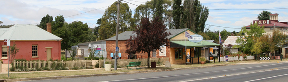
Nimmitabel is a charming historic village on the Monaro Plains which are located above the far south coast in New South Wales. It was once an important stopover for miners and prospectors making their way from the coast to the goldfields at Kiandra. Today it is a sleepy town with a small number of historic buildings.
Location
Nimmitabel is located on the Snowy Mountain Highway 434 km south-west of Sydney via Cooma. It is 1070 metres above sea level.
^ TOPOrigin of Name
There is some confusion about the spelling of the town's name and its meaning. The town has variously been spelt Nimity Bell, Nimmithyball, Nimoitebool, Nimmitybelle and Nibbitibel. It is said to be an Aboriginal word meaning "place where many waters start" or "dividing of the waters" but some sources claim it is a contraction of "inimitable".
^ TOPThings to See and Do
Heritage Walk
There is a useful Nimmitabel Visitor Guide (available at the Cooma Visitor Information Centre) which lists a very manageable eleven places of interest in the town. The map and general details are also on a sign outside the Geldmacher House and Museum. The most interesting are:
1. Geldmacher House Museum
At the corner of Bombala Street and Clarke Street is Geldmacher House, built around 1863 using locally made bricks. It originally was a general store. It was purchased by John Geldmacher in 1902. It then became part of the original Commercial Hotel and is now home to the Nimmitabel Heritage Centre where memorabilia from Nimmitabel's past is displayed.
2. Town Well
Near the intersection of the highway and Bentley Street is the old town well. It was constructed of local basalt around 1900 and covered by timber planks. A windlass and bucket were used to raise the water. The well was used by townsfolk during times of drought. In 1992 it was turned into a wishing well.
Tudor Inn and Old Commercial Hotel
On the western side of Bombala Street (the highway} as the visitor enters the town from the north is the faux Tudor Inn which was built c.1890 as Moran's Federal Hotel. Opposite is the old Commercial Hotel (1895), now a private residence.
3. Old Flour Mill
Up the hill on Clarke Street is the old flour mill (1865-72) which was built almost single-handedly by a German settler named John Geldmacher who also owned a store and other town allotments. The signage outside the building records that "soon after completion, he (Geldmacher) was informed that he could not operate the mill because it was within a prescribed distance of a public road. It was alleged that the shadow of the mill fans would frighten horses when passing along roads. Whether or not the mill ever functioned as a windmill is still the subject of research. Subsequently Geldmacher removed the wooden wings and converted it to horse power. It has been recorded that many old residents remember that some fine flour was produced. At some future date Geldmacher converted the flour mill to a timber mill." It is reputedly one of only two wind driven flour mills left in Australia.
3a. Community Centre
On his death Geldmacher left money for a town hospital which was used to establish the Bush Nursing Service on the site of his home, adjacent to the mill. This building is now the Community Health Centre.
4. Uniting Church
Located in Clarke Street and dating from 1904 this was previously the local Methodist Church. Made from hand cut local timber it is now privately owned.
6. Pioneer Cemetery
Located on Tom Groggin Road (at the end of North Boyd Road) is the town's old pioneer cemetery which has only 21 headstones but they date back to James Nokes who was buried 1842. It is the resting place of the first Greek migrant to Australia - a man named Gikas (Jigger) Boulgaris who died, aged 67, on 12 July 1874. In 2002 the Greek Orthodox community of Canberra and District held a special service to honour Boulgaris. For details on everyone buried in the cemetery check out http://www.monaropioneers.com/nimmitabel/memorials/cemetery.htm.
8. St Andrew's Catholic Church and St Joseph's Convent
Located in Kirke Street, which runs off Clarke Street, and at the top of the hill, is St Andrew's Catholic Church, the first Catholic church in the Monaro. There was a St Andrews before this building. The foundation stone of the current building was laid in 1856 and it was officially consecrated in 1865. There is a remarkable description of Archbishop Polding's visit to Nimmitabel in 1868 which offers an insight into the strength of Roman Catholicism in the Monaro at the time: "From Bombala to Nimmitybelle, somewhere between fifty and sixty miles, over beautiful rolling, undulating country, we came in grand procession. The McDonald Clan led by Chieftain and Pipers dressed in their traditional kilts, had the post of honour, and so seated in carts the pipers played their pipes. The Archbishop followed accompanied by Priests. Then came the Clan in colourful kilts and Highland dress, and they were followed by about eighty horsemen. Near Rocky Flat the cavalcade was met by the Cooma people into whose charge His Ghrace and Party were duly delivered. It was a beautiful sight. The Cooma horsemen above two hundred in number divided, each man standing by his horse bareheaded, and then reverently knelt for His Grace’s Blessing. The Nimmitybelle Clan followed , and then, wheeling around, fell to the rear, and so we came on to Rock Flat where refreshments were prepared. We then proceeded towards Cooma, upwards of three hundred horsemen and some in carriages. His Grace was received here amidst the greatest manifestation of enthusiasm." The church was extensively renovated and extended in 1918. Opposite is St Joseph's Convent and School (1902) which ceased to function as a school in 1982. For a very detailed account of the church's history check out http://www.monaropioneers.com/nimmitabel/churches/standrews.htm.
9. St Peter's Anglican Church
Located in Munro Street, St Peter's Anglican Church (1878-82) was first conceived by local businessmen in 1877. The church was designed by Reverend Richard Leigh from Berridale and the foundations cost £79/16/0. The foundation stone was laid in 1878. The building was completed in September, 1882. The building cost a total of £685. It is the only stone church in the Monaro and is built from black basalt rock. A book, Witnesses in Stone, describes the church as "The design is simple Gothic, with a steeply pitched roof over a sanctuary, nave and porch. The choice of black basalt was unusual, for this rock would have had to be transported by bullock dray to the site. Unusual though the choice was, the rock made St Peter’s the lovely church that it is, admirably sited on a hillock, which it shares with several old gnarled pine trees, overlooking the town. The grim charcoal-coloured exterior of St Peter’s contrasts with the soft off-whites of the interior. The absence of stained glass enables the church to be filled with an ethereal light, which filters through the transparent windows. The inside is brightness and light, a fitting atmosphere for an earthly sanctuary." For more information check out http://www.monaropioneers.com/nimmitabel/churches/stpeters.htm.
10. Royal Arms Guesthouse
Historically the Royal Arms Guesthouse was known as the Royal Oak Hotel. It was two buildings - a stone cottage which dated from c.1850 and the larger section which was probably built in the 1860s. The archway between the two buildings was used to shelter coaches. It is known that Biggenhook (1852-1914), the last of the Ngarigo Aborigines in the Cooma area, stayed at the hotel, helping with the children of the hoteliers. It appeared as the 'Australia Hotel' in the 1959 film The Sundowners which starred Robert Mitchum and Deborah Kerr. In 1959, at a time when Australia suffered acutely from "cultural cringe" having major Hollywood stars in a tiny rural town was very impressive and important.
11. Police Station and Lock Up
On the corner of Bombala Street and Clarke Street is the town's historic police station (1863) which consists of the offices, a residence, detached courthouse, two stone cells and three-stall stable. There was a police station in the town as early as 1854. The historic sign outside reads: "Tenders were called for the erection of a watchhouse on this site in 1861 ... work began in 1861 and was completed in May 1862. The guardroom was plastered in order that court procedures could be held in the watchhouse instead of a public house. In 1862 a request was made by the community for a courthouse. The courthouse was erected in front of the watchhouse. It was completed in 1863 ... the cells were decommissioned during the 1980s. In 2000 the cells and part of the police station were made into a police museum.
Lake Williams
Lake Williams, at the southern end of town, was created for the benefit of the Nimmitabel Community. It was officially opened on Australia Day 1994. It is a picnic and rest area where signs explain the history of Nimmitabel and picnic tables, barbecues, toilets (wheelchair accessible) and drinking water are available.
Elephant Sculpture
Located beside the local bakery is a huge (ie lifesize) Indian elephant. It is one of those quirky attractions designed to catch the attention of the passing traveller ... and it seems to work.
Other Attractions in the Area
Boco Rock Wind Farm
Located on the ridgelines 10 km south west of Nimmitabel the wind farm’s 67 turbines generate up to 113 MW of renewable energy. Wind farms generate a clean, renewable source of electricity and for Boco Rock Wind Farm that means the equivalent of approximately 50,000 houses will be supplied with clean energy and approximately 293,000 tonnes of carbon dioxide emissions will be displaced each year.
Wind monitoring has been underway on the site since 2007. The project received Development Approval from the NSW Government in 2010 for up to 122 turbines.
GE supplied the wind turbines for the project, and turbine components were sourced from around the world.
The ownership is fascinating. It was originally built by CWP Renewables (Continental Wind Partners) a company which was created in 2007 to develop wind farms in Romania and Poland. Although they still run the wind farm they sold it to the Electricity Generating Public Company (EGCO) in 2012. EGCO are an independent renewable power producer from Thailand.
Wadbilliga National Park
Located 52 km to the north west of Nimmitabel, the Wadbilliga National Park is a 98,530 ha area of rugged mountain ranges, wide plateaux, deep river valleys, wet sclerophyll forest, heathland, bogs and pockets of rainforest. It is a largely untouched wilderness area which lies between the Snowy Mountains and the coastal hinterland and is home to 122 species of native birds as well as swamp wallabies, echidnae, possums, platypus, eastern grey kangaroos and wombats.
The National Park contains two impressive highlights:
(a) The Tuross Falls (35 metres) and the 4 km Tuross Falls Walking Track. It is a medium difficulty walk which usually takes between 90 minutes and 2 hours 30 minutes. The falls can be viewed from the walking track which departs from the Cascades camping area where there are toilets, picnic and barbecue facilities.
Head east from Cooma through Numeralla and follow the road north towards Braidwood then turn right into Badja Forest Road. After 4.5 km is a signposted turnoff to the south (do not take the road to Nerrigundah). Follow this for 1.5 km until you come to another signpost which directs you south along Tuross Falls Road. For more detailed information check out http://www.nationalparks.nsw.gov.au/things-to-do/Walking-tracks/Tuross-Falls-walking-track.
(b) Cascades Walking Track and Viewing Platform described by National Park as "A short easy walk takes you to a viewing platform where you can watch the spectacular Tuross River tumble over boulders into a beautiful pool that makes for a gorgeous spot where you can swim, splash and cool down on a hot summer’s day. The pool is surrounded by a diverse range of plant life, from dwarf she-oaks and stunted mallee formed eucalypts on the dry ridge tops, to majestic white trunked ribbon gums on the river banks. Greater gliders can be spotlighted at night. You may also be lucky enough to see some of the larger owls such as the powerful owl and sooty owl, which depend on gliders for prey. There is also an abundance of other birds in the area. This tranquil swimming hole has good gravel road access, as well as picnic facilities, making it a perfect spot for a day trip getaway." For more detailed information check out http://www.nationalparks.nsw.gov.au/things-to-do/Walking-tracks/Cascades-walking-track-and-viewing-platform.
History
* Prior to European settlement the area was home to the Ngarigo Aborigines.
* The first European settlers had reached the district by 1839.
* In 1840 the tiny settlement became known as Nimoitebool.
* Properties in the area were taken up by graziers in the 1840s.
* The village began to develop in the 1850s around an intersection of tracks.
* The Nimmitabel Inn was established in 1854.
* A police station was in existence by 1855.
* The village was proclaimed in 1858. A post office opened that year and town allotments went on sale.
* By 1859 there was a store, a private school and a second hotel.
* The village picked up traffic bound for the Kiandra goldfields in the 1860s and it began to expand. A courthouse (1863), watchhouse, flour mill (1865), bank, provisional school and two churches soon appeared.
* In 1872 John Geldmacher completed work on his Mill.
* By 1885 the Geldmacher Mill had ceased operating.
* A butter factory was built when dairying began in the district towards the end of the 19th century.
* The railway arrived in 1912.
* A sawmill was opened in 1921.
* In 1959 Nimmitabel was used as one of the locations for the filming, by Warner Brothers, of Jon Cleary's novel The Sundowners.
* In 1961 the Monaro Shire Council started restoration work on the Old Mill.
* The railway to the town closed in 1988.
* The Boco Rock Wind Farm started in 2007.
^ TOPVisitor Information
The nearest visitor information centre is Cooma Visitors Centre, 119 Sharp Street, tel: 1800 636 525. Open seven days and from 7.00 am in the ski season.
^ TOPUseful Websites
There is an excellent local community website. Check it out at http://nimmitabel.nsw.au.
^ TOP
Thank you for the worthwhile information supplied. I’d like to know about the ‘private school operating from 1859’. Where was it? how big was it? How long did it operate?
Who owned or operated it? Is there a picture of it? Was it part of what is Nimmitabel Public school? I am interested as my grandparents taught at Adaminiby School at the end of the 19th century
The Matincas lived at 2 York St. between 1958-1966 then moved to Talbingo. Father worked for SMA.
Hi- my dads family were the Nolan’s and lived in this little town any places to stay if I bring him to visit ?
Much thx
Anne -Maree Norris