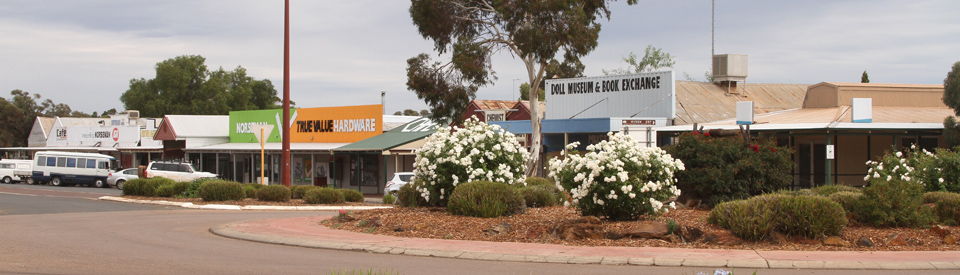
Gold mining town at the western end of the Nullarbor Plain.
Norseman is the last major town in Western Australia before heading east across the Nullarbor Plain. Started as a mining town by prospectors convinced that the area was as rich in gold as Kalgoorlie-Coolgardie, it has yielded over 100 tonnes of the precious metal since the late 19th century. It has always suffered acutely from it annual rainfall (it is only 276 mm) and a shortage of water. In the early years of settlement miners lived in houses that were primitively built and poorly maintained. Today Norseman is a large, sprawling town driven by mining and tourism, dominated by a huge (4 million tonnes of fine quartz) tailings dump, and vulnerable to the changing price of gold. It is sustained increasingly by the large numbers of people crossing the Nullarbor and using it as an important centre for supplies and information.
Location
Norseman, the last town in Western Australia before crossing the Nullarbor Plain, is located 725 km east of Perth and 278 m above sea level.
^ TOPOrigin of Name
Norseman started life as a mining camp. When gold was discovered in 1892 it was known simply as the 'Dundas Field' and the town which sprang up was simply called 'Dundas'. By 1894 it was known as 'Norseman' and had, reputedly, been named after a horse, 'Hardy Norseman", owned by a prospector named Laurie Sinclair. It has been claimed that 'Norseman' kicked at a large nugget on a site which Sinclair later pegged and discovered a substantial reef. Today Norseman, the horse, is honoured by a statue in the town.
^ TOPThings to See and Do
Beacon Hill Lookout
The best overview of the countryside around Norseman can be had from Beacon Hill which lies only 2 km from the town centre. It has seating, 360° views and there is a scenic walk down the hill. The view includes the remarkable Phoenix Tailings Storage Facility (which you pass on the way up) which is 40 metres high, holds 4 million tonnes of tailings and covers 12 ha of land; views of Lake Cowan; the Butterfly Tailings Storage Facility which ceased operating in 1986 and is slowly being rehabilitated; the Central Norseman Gold mine operation which has been mining in the area since 1936; and Mount Thirsty.
The Woodlands Walk
Located on the eastern outskirts of the town (it is easy to incorporate Beacon Hill Lookout into the walk) this 700 metre walk is through the woodland wilderness which surrounds the town. It has 13 interpretative panels along the way and is part of the 250,000 square kilometre woodland wilderness which surrounds Norseman.
Statue of Norseman
Given that the town was named after a horse, it is entirely appropriate that Norseman celebrate the discovery of gold with a statue of the horse that uncovered the first gold nugget in the area. There is a plaque beside the statue which explains: "This life size bronze sculpture of the horse called Norseman was erected by an elected fund raising body of Norseman residents to perpetuate the memory of the horse and the early pioneers of this town. The history of the Western Australian goldfields records the story of the discovery of Norseman by Laurie Sinclair on the 13 August 1894. Mr Sinclair was one of the six founders of Norseman, which also included his brother George Sinclair, Mr Allsop, Mr Ramsay, Mr Talbot and Mr Goodliffe. The story told, recounts Mr Laurie Sinclair's horse, Norseman, pawing up a very rich specimen of gold bearing ore on that fateful day and from it another chapter from the rush that never ended was born, and the town came into being. Mr Laurie Sinclair originally came from the Shetland Islands off the coast of Scotland and was proud to call himself a Norseman. Mr Laurie Sinclair called his horse Norseman after the Clan Norseman and named the new goldfield, Norseman, after his horse."
'Corrugated Iron Camels'
Located on Prinsep Street this really is one of the most unusual "tourist attractions" you are ever likely to see. The life size camels were created by Western Australian artist, Kurt Hotker, and are made out of corrugated iron. They are all wandering around the centre of the Prinsep Street roundabout. The sculptures are a tribute to the camel trains that carried the freight and mail to the town in the early days of settlement. They are also a reminder that Norseman has very wide streets because the camel trains needed to be able to turn around. The same applies to Coolgardie and Carnarvon.
Phoenix Park
This historical mining park is close to the town centre. Items of machinery, equipment and buildings representing the district's mining history are displayed along pathways with interpretive signage to explain their background. There are free barbecues and sheltered picnic tables.
Norseman Historical and Geological Museum
The Norseman Historical and Geological Museum, located at the old School of Mines Building (1940) in Battery Road, is currently run by volunteers. It has interesting displays of local memorabilia which focus on household and mining equipment from 1894-1920. It is open Monday to Saturday from 10.00 am - 1.00 pm and out of hours tel: (08) 9039 1071.
The Longest Golf Course in the World
Nullarbor Links Golf Course
A very typical Aussie outback joke the Nullarbor Links Golf Course is the world’s longest golf course with the first hole in Ceduna, South Australia and the 18th hole 1365 km away at Kalgoorlie. Check out the details at http://www.nullarborlinks.com. It is real and can be a lot of fun for committed golfers. There are two holes at Norseman - the Ngadju Par 4 - 354 metres and the Golden Horse Par 4 - 436 metres. Both are on the Norseman Golf Club.
Hole 14: Golden Horse Par 4 and is 436 metres.
Located at the Norseman Golf Club this is a relatively easy flat hole characterised by little grass on the fairway and an astroturf "green".
Robbie’s Guide to the Nullarbor Links
A behemoth par 4 at 437 metres long, which doglegs at about the 200m mark towards the left. The corner is well protected by scrub, but the green is open on all sides with room avoid being punished for a missed approach shot.
The notes on the website explain: "Gold mining in the Norseman area began with the chance discovery of gold at nearby Lake Dundas in 1892. A gold rush soon began. Today however the original Dundas fields now lie abandoned. According to local legend the town of Norseman was named after a horse. It is said that in 1894 a horse named Hardy Norseman was tethered to a tree for the night by its owner, Laurie Sinclair. Upon returning to his horse Sinclair had the good fortune to discover that Norseman had unearthed a gold nugget. Since then a statue has been erected in honour of Norseman. Today Gold Mining continues to be a major activity with reports that the Norseman fields have produced over 5 million ounces of the precious yellow metal." The tee is called Laurie Sinclair.
Hole 15: Ngadju Par 4 and is 353 metres. Located at the Norseman Golf Club, this is the hole back to the Clubhouse and, like the Golden Horse hole it is an uncomplicated, flat, rather grassless, hole.
Robbie’s Guide to the Nullarbor Links
A comfortable par 4, which dog-legs slightly right at about 100m from the green. Right side of the fairway is preferable from the tee, opening up a second shot past the dog leg.
The notes on the website explain: "You are now standing on Ngadju ground and the Ngadju people are the traditional owners of the land. The lake you see in the foreground is called Warrarnbunna meaning the place of the long ground. The eucalypt forest around us is the largest woodland forest on the earth and called the Great Western Woodland. Let us all enjoy and protect.
This tee commemorates one of Norseman's true pioneers, Mort Harslett, who lived his whole life here. Mort worked on the mines, provided services to the State School as caretaker/cleaner and was a founding member of the Historical Museum, but is mostly remembered for the many years of operating a mail delivery in the early days to properties out on the Nullarbor in his trusty old truck. He told fascinating yarns of the early years and had a wealth of knowledge relating to the history of the Dundas Shire." The tee is called Mort Harslett.
Other Attractions in the Area
Dundas Coach Road Heritage Trail
There is an excellent brochure - http://www.dundas.wa.gov.au/Assets/Documents/Content/Dundas_Coach_Road_Heritage_Trail.pdf - which describes this 25 km trail (50 km round trip) from Dundas to Norseman which was the original Cobb & Co coach route. Dundas was the original town in the area but it was very short-lived. It was created in 1893 but by 1894 richer deposits of gold had been found at Norseman. By 1896 the first coach had made the journey between the two miners settlements. As the brochure explains: "The Dundas Coach Road Heritage Trail features 10 stopping places spread along the 25 km between Norseman and the site of the original township of Dundas. Each site features fascinating interpretative stories that help build a picture of life in the early years along the Coach Road. Some sites have picnic tables, others have walk trails - all showcase the life and times of the hardy folk who flocked to the Dundas goldfields." The sites along the route include rusty old pieces of equipment, holes in the ground (reworked as recently as the 1960s); mullock heaps everywhere where miners have dug holes in the hope of finding their fortune; signs warning other prospectors (and particularly people with metal detectors) to stay away; a lonely grave of a solitary 27-year old who died in the middle of nowhere; abandoned headframes; an old dam built in a desperate attempt to save enough water in this parched land; and the remnants of a cricket pitch built in 1893 by some miners eager to have a little social entertainment.
Dundas and Dundas Rocks
These huge ancient rock formations, over 2 million years old, are scattered through the bush some 22 kilometres south of Norseman. It is a perfect day trip with walking, climbing, wildflowers (in season) and a bushland picnic facility for you to enjoy. A plaque identifying the old Dundas townsite, the first settlement in this area, is located nearby. BBQ facilities are onsite.
Mount Jimberlana
Mount Jimberlana, which is located 5 km east of Norseman. It has been estimated that the granite rocks in this area are nearly 2,900 million years old. The dry lake chain to the north indicates the past existence of an ancient river system. It is possible to walk to the top of the rock which provides outstanding views of the surrounding area.
Buldania Rocks
Located 26 km east of Norseman on the Eyre Highway the Buldania Rocks are famous for their large number of "Gnamma Holes" - these are natural cavities where rainwater is collected and stored by nature.
Fraser Range Station
Located 105 km east of Norseman this huge property was originally explored by John and Alexander Forrest on their expedition to Adelaide in 1870. Fraser Range Station was first settled by the Dempster brothers in 1872 making it the first station to be founded on the Nullarbor Plain. It is not on the true Nullarbor Plain in the sense that it is "covered by dense hardwood eucalyptus forest composed of blackbutts, salmon gums and gimlets. The trees are substantial, some towering 20 to 30 metres tall, with dense undergrowth making vehicle access off cleared tracks impenetrable." The property offers accommodation and a range of tours. Check out http://www.fraserrangestation.com.au/ or phone (08) 9039 3210.
The Granite and Woodlands Discovery Trail
If you are driving east from Norseman this remarkable 300 km unsealed trail from Norseman to Wave Rock at Hyden has sixteen locations including Disappointment Rock Walk Trail (2 km), McDermid Rock Walk Trail (1.2 km), the Woodlands Walk, the Breakaways campsite and Wave Rock. For more information tel: (08) 9039 1205 and download the detailed trail brochure at http://www.dundas.wa.gov.au/Assets/Images/Content/Shire_Of_Dundas_Woodland_Granite.pdf.
History
* Prior to the arrival of Europeans the area was inhabited by the Ngadju group of the Malpa Aborigines.
* The first European into the area was the explorer Edward John Eyre who passed through in 1841.
* In 1848 the explorer JS Roe passed through the area and named the Dundas Hills.
* By 1864-1864 a sheep station had been established near Esperance.
* The explorer John Forrest travelled from Western Australia to South Australia in 1871.
* In the decade after Forrest explored the country properties were established at Mundrabilla, Fraser Range and Balladonia.
* The first gold was discovered by a Mr Moir in 1890 near Fanny's Creek.
* Gold was discovered in the area in 1892 on what became known as the 'Dundas Field' and the town which sprang up in this harsh and inhospitable environment was called 'Dundas', for the lack of anything better.
* In 1894 the town which had sprung up to service the miners was named 'Norseman' after a horse owned by a prospector named Laurie Sinclair.
* By 1895 Norseman had been proclaimed a town. That year the town acquired its first Post Office and a doctor arrived in the town.
* The town became a municipality in 1896. That same year it was connected to the telegraph.
* The Norseman Volunteer Fire Brigade was formed in 1898.
* In 1899 a water reservoir capable of holding 3 million gallons was completed. By that time the town had five hotels, three churches and was regularly served by Cobb & Co coaches.
* In 1901 a brewery was built.
* In 1902 the town of Princess Royal was established north of Norseman. It had disappeared by the 1920s.
* By 1905 the population had reached 3000.
* The railway from Coolgardie reached the town in 1909.
* 1910 saw the construction of the town's first theatre. It could hold 600 people.
* The town's first golf club opened in 1914.
* The railway reached through to Esperance in 1929.
* It wasn't until 1936 that the town managed to have a reliable water service when a pipeline connecting Coolgardie to Norseman was completed.
* In 1941 the southern road through to Esperance and Port Augusta was upgraded.
* By 1953 the town had an Olympic Swimming Pool.
* The road to Coolgardie was sealed in 1956.
* Today there are a number of small gold mining operations in the area.
^ TOPVisitor Information
Norseman Visitor Centre, Welcome Park, tel: (08) 9039 1071
^ TOPUseful Websites
There are two useful local websites. Check out http://www.norseman.info and http://www.dundas.wa.gov.au.
^ TOP
Your Main St looks nice!
https://www.facebook.com/norsemanmensshed/
Could you please add Norseman Men Shed Association Inc at 104 Prinsep St as a local attraction.
More information is available on our Facebook page.
What was the Lot number of mr and Mrs. L Gatti, Princep St around year 1925.
How would you travel to get from Norseman to Esperance in 1917. Was there shipping to get from Esperance to Melbourne by sea. Where there many schools, hospitals, churches at this time What was the average temperature in summer and winter. Most of the rainfall would come from thunderstorms? What was the average rainfall in that era. Where the aboriginal community used by Europeans as workers for them. My great Uncle was an Anglican preacher there. his name was Rev Lionel Vingoe Caldwell. I would like to get a feel of Norseman that faced his wife Caroline, Stewart (2) and Lorna who was born there 3.3.1916. Thank you.
MY GREAT UNCLE STANLEY DURRANS LIVED HERE IN 1920’S.
Can anybody please tell me if there is satisfactory mobile phone coverage in Norseman?
Yes mobile coverage is fine
Does anybody have any history on Arthur Dunleavy Hill and his wife Marguerite Elizabeth Badcock who got married there in 1905?
Norseman in WA is not the end of the Nullarbor Plain, because that is just a short length of Kms that starts in SA and ends before you get to the SA WA Boarder.
I know this because the word Nullarbor means no trees in the Indigenous language. It starts at about 200Kms West of Ceduna and ends just past Nullarbor Station, I also drove over it twice a week for well over 30 years.
I am interested to learn more about cameleers especially those with last name SINGH
Can anyone tell me what happend to the single men quarters that I Lived in back in 1980. Loved my time in Norseman 👍