Elegant town on the Bellarine Peninsula
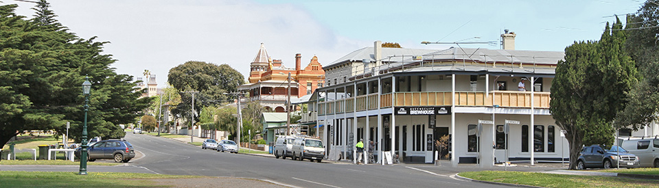
Queenscliff is a charming seaside resort noted for its elegant heritage hotels, gracious guesthouses, galleries, some substantial public buildings, chic restaurants, cafes, a fine golf course, wide streets faced by terraced houses and both bay and surf beaches. The town is located on an isthmus at the south-eastern tip of the Bellarine Peninsula just inside the entrance to Port Phillip Bay. On one side is Swan Bay and, on the other, Shortland Bluff overlooks the channels leading into Port Phillip Bay. The town came into existence in the 1880s when wealthy Victorian society recognised it as a fashionable summer holiday resort. Grand hotels were built and a sense of opulence, broken only by the modest workers cottages for the pilots who brought ships into the bay, pervaded this interesting and unusual holiday resort town.
Location
Queenscliff sits just inside the entrance to Port Phillip Bay and is 103 km south-west of Melbourne and 28 km east of Geelong. It is 15 metres above sea level.
^ TOPOrigin of Name
Queenscliff was originally named Shortlands Bluff after Peter Shortland who was a member of an 1836 survey party. It was officially changed to Queenscliff in 1854 as a way of honouring Queen Victoria.
^ TOPThings to See and Do
A Beach Walk with Lookouts
A perfect way to start any visit to Queenscliff is to head for Queenscliff Foreshore Reserve at the end of Symonds Street, walk through Princess Park and along the Queenscliff South Pier which dates from 1884. The walk south along the beach to the next jetty. In the Victorian era there were hot sea baths and a bathing enclosure on this section of the beach. Walk up Thwaites Steps to Shortland Bluff lookout and the Queenscliff High Light where there are views over Port Phillip - north to the city skyline and east to the Dandenong Ranges, Mt Eliza and Arthurs Seat.
Queenscliffe Maritime Museum
Located at 2 Wharf Street and surrounded by large pieces of maritime memorabilia, the Queenscliffe Maritime Museum has been operating since 1980. The museum opened in 1986 and today has a wide range of exhibits relating to sea rescue, shipping and other aspects of maritime history, including the 'Queenscliffe' lifeboat (the last of four lifeboats which were continuously stationed at Queenscliff from 1856 to 1976), a hydrographic model of The Rip (the dangerous entrance to Port Phillip which has caused many wrecks), a dive display with an early diving suit, shipwreck artefacts, lifesaving equipment, a sea kayak display, historical postcards and nautical pictures and a substantial collection of model ships. The museum is open daily from 11.00 am - 4.00 pm, tel: (03) 5258 3440 or check out https://maritimequeenscliffe.org.au.
Outside the Museum
Outside the museum are a number of nautical artefacts including (a) the anchor from the Sussex which ran aground on a reef two kilometres west of Barwon Heads in 1871 (b) two spherical shaped yellow buoys which were used to identify a gas pipeline in Port Phillip (c) the propellor from the tug Melbourne (d) the screws from the Submarine J-3 which sank near Swan Island in 1924 and (e) the anchor from the barque Eliza Ramsden - it sank in 1875.
Queenscliff Pier and the Art Exhibition
Located on the Queenscliff Pier, the Queenscliff Art Prize is an unusual outdoor art exhibition where one hundred works by Australian artists are exhibited above the water on the historic pier from the beginning of November until the end of April. It started in 2021-2022 and it is hoped to continue annually. The participating artist’s original work has been printed onto a composite aluminium panel, and these panels have now been installed on the pier. When the art works are removed in April they will be exhibited in wineries around Australia.
Queenscliff Heritage Walk
The Visitor Information Centre has, for sale, a booklet titled Queenscliff - A Living Heritage - which is a self-guided tour of the town's historic buildings. It takes around 45 minutes. Queenscliff is rich in important buildings from the late 19th and early 20th centuries. Those listed on the Victorian Heritage Database include:
(a) Gellibrand Street
Gellibrand Street captures the essence of elegant Queenstown. It is awash with impressive buildings and the hotels tell a story of opulence and sophisticated beach holidays. The Victorian Heritage Database lists ten buildings in the street.
Mementoes in the Park
Located at the very bottom of Gellibrand Street are a number of nautical objects designed to add to the flavour of any historic experience of the town.
Wreck Bell
On the corner of Gellibrand Street and Wharf Street is a ship's bell with the suitably intimidating sign: "Any person found ringing the bell except in the case of shipwreck or marine disaster will be prosecuted." The bell is listed on the Victorian Heritage Database which explains: "The Wreck Bell was a facility provided by the Ports and Harbours Branch to summon the crew of the Queenscliff lifeboat in times of a maritime disaster. The bell was cast by John Danks & Son, Melbourne, and the supporting structure erected by William Golightly (Jnr) in September 1891. It was placed in Lower Princess Park close to the residences of the fishermen who generally formed the crew of the lifeboat. The head of the lighthouse service was automatically the lifeboat's coxswain. When the lifeboat was required for assistance in a maritime emergency such as a search and rescue involving a shipwreck, the bell was rung to alert the voluntary crew. Prior to 1891, analarm bell mounted on the Signal Mastat Shortland Bluff was rung by the Signal Master to call out the lifeboat crew. The Wreck Bell was used to call the crew on many occasions, the last being in 1974 when they were called out to a fire on the vessel Brisbane Trader ... The bell, still in its original location, is mounted on a two metre high square timber post, which is supported and bolted to two upright rectangular timbers embedded into a rectangular platform base. At the top of the post, a bifurcated yoke belfry surrounds the bell ... The bifurcated yoke structure housing the Wreck Bell, along with the bell, platform base, and ladder are original." See http://vhd.heritage.vic.gov.au/places/result_detail/13040?print=true.
Swivel Link
Over the other side of Gellibrand Street is the Swivel Link - a huge metal link mounted on a plinth with the explanation "Swivel Link from H.M. Colonial Steam Sloop Victoria - Australia's first warship built 1854, cost £38,000. In service 40 years."
The Esplanade Hotel
Located at the bottom of Gellibrand Street (at number 2), The Esplanade, which was built at the end of the 19th century, is a fine example of the boom era hotels which were built when the town became one of Victoria's premier holiday destinations. "It is of historical and aesthetic (architectural) significance as an imposing Victorian hotel complex on a key site in Queenscliff." See https://vhd.heritagecouncil.vic.gov.au/places/120374 for more information.
Queenscliff Hotel
Located at 16 Gellibrand Street, and built in 1887 for Martha Nugent and Joseph Goslin, this "hotel is of architectural significance as a very early and well-integrated Australian example of the eclectic English 'Queen Anne' architectural style, with extensive verandahs reflecting its resort use as much as its Antipodean location. The polygonal tower, with its coned roof and bellcast profile, and the Dutch gables, with steep slit openings, are of interest for their reflection of northern European Renaissance architecture, particularly from countries as such France and the Netherlands. The Queenscliff Hotel is also architecturally significant as an extraordinary example of work by the highly successful Melbourne architectural firm, Reed, Henderson & Smart, who were responsible for the introduction of radical red brick eclecticism to architecture in Victoria during the 1880s." One observer has noted on the hotel: "The building had and has great character ... the original owners, sister Nugent and brother Goslin had it purpose built in 1887 in the style of a large house rather than a public building (even to the extent of excluding a ballroom, a most unusual decision for the times) and went against the tide of florid Victoriana and with the William Morris aesthetic movement. It features two-storey bay windows, some fine lacework, Flemish gables, an enclosed tower and a fine dining room." For more information check out https://vhd.heritagecouncil.vic.gov.au/places/120375.
Clydesville
Located at 20 Gellibrand Street, and set back from the roadway, this house was built in the 1860s has was the residence of the local pilot, John Nicholson. It was used as a summer house by "Charles Troedel, the most distinguished of Melbourne's nineteenth century lithographers and later the owner of the Sydney-based printers C Troedel & Company." For more information check https://vhd.heritagecouncil.vic.gov.au/places/120377.
Caribou Cottage
Located at 22 Gellibrand Street, this unusual cottage, which dates from the 1870s, was built as a private dwelling but soon became a branch of the State Saving Bank of Victoria. The Victorian Heritage Database notes: "The original owner was William Sampson Jamieson, a baker in Queenscliff in the 1860s, and later (by 1886) Mayor of the Borough. Architecturally, while an evolved building and not externally intact to its original 1870s form and appearance Caribou Cottage has a highly decorated facade, with an unusual composition and somewhat awkward application of Classically-inspired detailing. Elements of note include the vermiculated quoining, entrance flanked by slender Classically-inspired columns, and the window treatment of rendered architraves with keystone and projecting cornice above." For more information check out https://vhd.heritagecouncil.vic.gov.au/places/120378.
Lisowen
Located at 32 Gellibrand Street, Lisowen is a charming example of a Queen Anne style timber cottage. The house was bullt and once owned by the well known and prominent Melbourne family, Baillieu, who later leased it to doctors. See https://vhd.heritagecouncil.vic.gov.au/places/120379 for more details.
Ozone Hotel
Located at 42 Gellibrand Street, the Ozone Hotel, originally known as Bailleau House, was built in 1881-82 for James George Baillieu. It is, by any measure, a superb old hotel with three storeys and a tower that offers great views over the town and Port Phillip Bay. The current name honours a paddlesteamer which carried passengers from Melbourne in the late 19th century when Queenscliff was a highly fashionable resort for the state capital's wealthier classes. The steamer was sunk off the coast of Indented Head to form a breakwater and can still be seen above the waterline. The hotel is listed in the Victorian Heritage Database which notes: "The Ozone Hotel, once referred to as the "Queen of Watering Places", is of social significance for its associations with wealthy Victorian society around the turn of the century who regarded Queenscliff as a fashionable summer holiday resort ... The hotel is of architectural significance as a fine example of a three-storey picturesque Italianate styled building, asymmetrically composed and dominated by a French Renaissance tower with a mansard roof and widow's walk ... The hotel is of historical significance for its association with James George Baillieu, patriarch of the prominent Baillieu family, members of which were notable as financiers, politicians, pastoralists and racehorse owners." See https://vhd.heritagecouncil.vic.gov.au/places/120380 for more detailed information.
Lathamstowe Hotel
Located at 44 Gellibrand Street (on the corner with Stokes Street) is the former Lathamstowe Hotel which was built in 1882-83 by Edward Latham, a brewer who founded the Carlton Brewery. Part of Melbourne society, he married Emma Bailleau, the daughter of George Bailleau who built the Ozone Hotel. It was designed by the architect, William J Ellis "specifically for the use of the Anglican clergy as a seaside holiday residence. The two-storeyed building consists of a pair of Italianate residences in a duplex arrangement combined with a corner tower." For more details check out https://vhd.heritagecouncil.vic.gov.au/places/120381.
Pilots Cottages
Located at 60-62 and 66-68 Gellibrand Street, there are four well preserved examples of residences built to house the pilots and boat crews which greeted the ships arriving at Port Phillip. The history of their construction and use is complex and explained in great detail at https://vhd.heritagecouncil.vic.gov.au/places/120383. The Database notes: "George Admans, Queenscliff builder and hotel owner, carried out his first construction commission in the colony by erecting these cottages after what he claimed was a long wait for material. Work commenced on the pilots' quarters under the direction of acting Colonial Architect, James Balmain, late in 1853. By mid 1854, the work was completed at a cost of £200 per cottage. Of these nine cottages, only four were occupied by pilots by 1858: the balance being occupied by the health officer and his boat crew, who formerly had occupied quarters on the beach, and the police, for whom a reserve subsequently was created in 1865 ... the duplex (Nos. 60-62) represents a rare building type and style combination in Victoria; that of domestic Gothic and row house construction. The window bays to each gable bay and their concave sheeted roofs, combined with simple timber capitals and brackets to the veranda (added), provide a convincing reminder of Pilots' Row. The building is intact within its vernacular, but the former picket fence has been replaced. Nos.66-68 Gellibrand Street is all that remains of Pilot's Row. The porch entrances, with their lancet, twelve pane windows, the central hexagonal-plan chimney and wide softwood boards are all original.
Fort Queenscliff
Standing prominently at the top of Gellibrand Street at 1 King Street is Fort Queenscliff which was built so it could observe the commercial shipping lanes through the entrance to Port Phillip Bay. Cannons were first installed here during the Crimean War (1853-56). They were manned by volunteers from 1860 but little was done until the early 1880s when fears of a Russian invasion arose. Fort Queenscliff was designed to prevent attacks from enemy shipping and from land assault, hence there is a loopholed fort wall, a dry moat (once crossed by a drawbridge) and a castellated keep, along with the guardroom, cells, an underground shell magazine and muzzle-loading cannons.
Coastal Fortress and Museum
The Museum has a variety of interesting exhibits including military operations over the past 120 years, a range of weapons and ammunition, a collection of military awards and decorations, documents and photographs. See https://www.fortqueenscliff.com.au/fort-museum/ for a virtual tour and detailed information.
Shortland Bluff Black Lighthouse
On the grounds of Fort Queenscliff is the 'Black' Lighthouse. It is the only one of its kind in Australia and is made from unpainted bluestone. The Lighthouses of Australian website explains: "There are two greatly disputed stories of the origins of the bluestone used to build the lighthouse. One version claims that the stone came from Scotland already cut and dressed as ship’s ballast. The other version which is considered to be the official one is that the stone was quarried in Melbourne and brought by barge to Queenscliff. Proponents of this theory claim that the barging in of the stone is what lead to the misconception over the origin of the stone." See https://lighthouses.org.au/vic/shortland-bluff-lighthouse/ for more details.
In conjunction with the 'White' Lighthouse (which can be accessed at the end of Hesse Street) it helped to steer ships through the dangerous waters at the entrance to Port Phillip Bay. The stone administration centre was built in 1856. It housed Queenscliff's courthouse, post office, telegraph station and police station until 1882. Access to the fort is only by guided tour. The tours occur on weekdays at 11.00 am and on weekends at 11.00 am and 1.45 pm. The tour takes 90 minutes. The website explains that it is: "a guided tour of a 19th Century Coastal Artillery Fort (operating as an Australian Army Base) with over 150 years of Australia’s heritage on display. You will see historic Fort features covering activities of an artillery garrison, and hear about an artillery soldier’s life between 1860 and 1946, and the activities of the Department of Defence to the current date." For more information, tel: (03) 5258 1488 or check https://www.fortqueenscliff.com.au.
(b) Hesse Street
Hesse Street is Queenscliff's main street. It stretches from the main shopping centre, through a section of the Bellarine Highway, to the shore where there is a carpark and a lookout which provides panoramic south-westerly views over The Rip - a 3 km stretch of water dividing Point Lonsdale and Point Nepean. The Rip is recognised as one of the most dangerous stretches of water on the whole Australian coastline.
Start at the bottom of Hesse Street and note the following:
Sea View House
Located at 27 Hesse Street, the Sea View House is listed in the Victorian Heritage Database because it is "an imposing and relatively intact two-storey timber residence from the mod Victorian period." See https://vhd.heritagecouncil.vic.gov.au/places/120592 for more details.
Vue Grand Hotel
Located at 46 Hesse Street is the ornate Vue Grand, with its tiled floor and marble columns. It was erected in 1881-82 with a front section rebuilt in 1927 after a fire. Listed in the Victorian Heritage Database it is significant "to Queenscliffe in demonstrating many characteristics and facilities of a substantial nineteenth century Victorian resort hotel." It is another example of a hotel built in the town during the boom in the 1880s. For more information check out https://vhd.heritagecouncil.vic.gov.au/places/120594.
Post Office
Located over the road from the Vue Grand Hotel at 47 Hesse Street, the Queenscliff Post Office was built in 1887. It has operated as a post office ever since and is recognised by the Victorian Heritage Register as "one of a group of post offices constructed in an Elizabethan revival style as compared with the Victorian Italianate style which dominated post office design in the late nineteenth century." For more detailed information check out https://vhd.heritagecouncil.vic.gov.au/places/120595.
Queenscliffe Historical Museum
Located at 49 Hesse Street, the Queenscliffe Historical Museum houses over 10,000 items, including including photographs, documents, paintings, newspapers and toys, documenting Queenscliff, Point Lonsdale and Swan Bay's history. It is open Monday, Tuesday, Wednesday and Friday from 11.00 am - 4.00 pm and on weekends from 1.00 pm - 4.00 pm, tel: (03) 5258 2511 or check out http://www.historyofqueenscliffe.com.
Public Library
Located at 55 Hesse Street, the Free Public Library is the earliest municipal building in the town which is still in use. It is "based on the Italian Renaissance, the combination of stucco and face-brick with the style adopted indicates a more direct influence from the English Queen Anne." See https://vhd.heritagecouncil.vic.gov.au/places/120596.
Commercial Building
Located at 58 Hesse Street and listed by the Victorian Heritage Database, this elegant Victorian-era shop and residence is relatively intact and, with its elaborate decoration and relatively intact appearance, it gives the viewer an idea of what a shop and residence looked like at the end of the 19th century. Check out https://vhd.heritagecouncil.vic.gov.au/places/120597.
Queenscliff Inn
Located at 59 Hesse Street, the Queenscliff Inn is a well preserved example of early 20th century guest house. Check out https://vhd.heritagecouncil.vic.gov.au/places/120598 for more details.
Oceania House
Located 61 Hesse Street, Oceania House is listed on the Victorian Heritage Database which explains that "Architecturally, Oceania House is significant as an example of the Queenscliff vernacular style of early two storey residences, albeit built in the 1880s, and one of relatively few substantial weatherboard, two-storey, hipped roofed verandahed dwellings in the town. It is additionally enhanced by its external decorative treatment, including to the verandah and front door." Check out https://vhd.heritagecouncil.vic.gov.au/places/120600.
Wesleyan Church and Methodist Sunday School
Located at 81 Hesse Street these two churches date, respectively, to 1868 and 1888. The Victorian Heritage Database notes of the two buildings: "The former Methodist Church is aesthetically significant as a well designed and detailed late nineteenth century church building designed in a Gothic Revival style ... The former Methodist Church is architecturally significant as an example of the work of the prominent Melbourne architectural firm of Oakden Addison & Kemp." For more detailed information check out https://vhd.heritagecouncil.vic.gov.au/places/120605.
St Andrews Uniting Church
Located at 83-89 Hesse Street, St Andrews Uniting Church, which was previously a Methodist Church, is listed by the Victorian Heritage Database which notes of its architecture "the sexagonal plan-shapes do reflect the contemporary revival in church building of Byzantine elements and these shapes are well expressed in the elevation." For more information check out https://vhd.heritagecouncil.vic.gov.au/places/120606.
Seaview Guest House
Located on the corner of Hesse Street and Stokes Street, Seaview House is a fine example of a seaside resort guest house designed to cater from holidaymakers around the beginning of the twentieth century. It was subsequently turned into a coffee palace. For more details check https://vhd.heritagecouncil.vic.gov.au/places/120607.
Royal Hotel
Located at 34-38 King Street, the Royal Hotel, because it is so far removed from the centre of Queenscliff, is a reminder of just how substantial the town was as a holiday resort destination by the 1880s. A hotel had occupied this site since 1854 and this building was put on the market for $4.1 million (it has 10 bedrooms and 7 bathrooms) in 2019. It is listed by the Victorian Heritage Database at https://vhd.heritagecouncil.vic.gov.au/places/120698.
Other Attractions in the Area
Bellarine Rail Trail
The Bellarine Rail Trail, a walking and cycling track, runs for 32.5 km from Queenscliff (the route begins opposite the railway station near the carriage sidings) through Drysdale to South Geelong. It is recognised as a hilly route which passes through farmland, native vegetation and along the edge of Swan Bay. For more detailed information check out https://www.railtrails.org.au/trail?view=trail&id=139.
Swan Bay
Swan Bay lies on the northern side of the Queenscliff isthmus. Access to the beach is 8 km north of Queenscliff. The bay is characterised by quiet sheltered waters which are good for fishing and boating. There is a boat ramp. Swan Bay is also a recognised wetland habitat which is a haven for birds such as the orange-bellied parrot.
Swan Bay Edwards Point Wildlife Reserve
Located 19 km north of Queenscliff, the Swan Bay Edwards Point Wildlife Reserve, as Parks Victoria explains, "protects the last remaining stand of coastal woodland on the Bellarine Peninsula ... The Two Bays Lookout at Edwards Point Wildlife Reserve provides visitors with the opportunity to explore remote beaches which provide habitat for resident and migratory wader birds with views of both Port Phillip and Swan Bay. A number of walks throughout the reserve allow you to explore the breathtaking views, sandy beaches, cool coastal woodlands and extensive salt marsh communities of the area. Interpretation signage provides visitors with information on the significance of this Ramsar site and the international flyway." See https://www.parks.vic.gov.au/places-to-see/sites/edwards-point-two-bays-lookout-.
Adventure Park
Located at 1249 Bellarine Highway, Wallington - 12 km from Queenstown - is Adventure Park. Set in parkland it has a wide range of activities for families, including ten water-based activities including a 115-metre raft waterslide and a jumping jets water park; mini golf - Fortress Falls and Skeleton Creek; a little buggy speedway; a grand carousel and ferris wheel. Facilities include a kiosk and cafe, undercover seating and wheelchair access. Gas barbecues and VIP cabanas are available for hire. Opening hours are from 10.00 am to 5.00 pm (although they vary slightly due to school holidays) seven days a week. Check out https://www.adventurepark.com.au/park-info/opening-hours for details. Adventure Park is closed for about two months each winter, approximately from July to September, tel: (03) 5250 2756 or https://www.adventurepark.com.au/. A site map is available from the admission centre and can be downloaded from the website.
South Channel Fort
The South Channel Fort is a small artificial island located near the opening to Port Phillip Bay in the Point Nepean National Park. Work began on the construction of the island in 1879 when about 14,000 tons of bluestone rocks (mostly weighing over two tons) were laid in a ring and concrete cylinders were sunk to the base rock. On this base a table of concrete and brick formed the base for the fort. The aim of the fort to illuminate with searchlights and guard the main route through the shoals to Melbourne and to electrically detonate a series of sub-aquatic mines which were designed to attack ships entering Port Phillip.
The decision to build the fort was based on a fear of a Russian invasion. Two eight inch muzzle-loading guns were mounted with a range of 9 km. Between the 1890s and 1916 the fort was fully manned with around 100 people living and working on the island.
The Fort became redundant when defence guns were installed at Fort Nepean and Queenscliff in the early years of the 20th century. By 1918 only a few men were garrisoned at South Channel Fort and it was decommissioned after World War II and used as a magazine and then a weather station.
Many of the original fortifications, gun emplacements, magazines and subterranean passages remain intact though access is limited. The island offers fine views and it is also a declared sanctuary and one of only three breeding sites for the white-faced storm petrel in Victoria. Owing to the fragility of their nesting burrows visitors are restricted to a defined network of paths. Parks Victoria note that "The island is used by a number of other species for breeding, offshore feeding and roosting. Species include the Little Penguin, Black-faced Cormorant and the Australian Fur Seal. Five species of bird that visit the island are under international migratory bird agreements."
There is a useful Parks Victoria sheet with a map and details which can be downloaded at https://parkweb.vic.gov.au/__data/assets/pdf_file/0006/315564/Park-note-Point-Nepean-NP-South-Channel-Fort.pdf.
There are a number of tours most of which depart from Sorrento. Check out http://watermaarq.com.au/scenic-south-channel-fort-rib-boat-tour; http://www.riptidecharters.com.au/services.html; and https://www.thereelthing.com.au/scenic-tours.
Scotchmans Hill Winery
Located at 190 Scotchmans Road, Scotchmans Hill Winery was established in 1982 and is worth visiting as it offers superb views over Port Phillip Bay ... and has some exceptional cool climate wines for sale. It produces pinot gris and an award-winning chardonnay, along with cabernet sauvignon, sauvignon blanc and riesling. The cellar door is open daily from 10.30 am to 4.30 pm, tel: (03) 5251 4431. For more information check out https://www.scotchmans.com.au.
Tuckerberry Hill
Located at 35 Becks Road, Tuckerberry Hill, a berry and fresh produce farm, is open Friday to Sunday from 9.00 am - 4.00 pm. It specialises in local produce and has a charming cafe. It is possible to pick your own blackberries from 26 December to the end of February. Blueberry jams, juice, chutneys, muffins and toppings and blueberry plants are available all year round, tel: (03) 5251 3468. Check out their Facebook page at https://www.facebook.com/pg/TuckerberryHill.
History
* Prior to the arrival of Europeans the area was home to the Wathawurung Aborigines.
* In 1802 Lieutenant John Murray spent three weeks exploring the coast and the entrance to Port Phillip Bay.
* Later in 1802 Matthew Flinders mistook Port Phillip Bay for Western Port and entered, and explored, the bay.
* In 1803 a convict escapee from a settlement on Port Phillip Bay, named William Buckley, made his way to the Bellarine Peninsula and was adopted by the local Aborigines who thought him a reincarnation of a dead leader. He lived with them for over 30 years, most of it presumably spent on the Bellarine Peninsula.
* In 1835 Buckley allegedly overheard the Aborigines plotting to attack a party of Europeans at Indented Head and he gave himself up to the party of John Wedge.
* In 1838 George Tobin was licensed to operate a pilot service from the beach below Shortland Bluff (then a heavily wooded headland) where he and his crew lived. Tobin was soon joined by other operators. The pilot boats steered ships through the treacherous waters of The Rip at the entrance to Port Phillip Bay.
* The area was named Whale Head in 1836 but was soon renamed Shortland Bluff after a midshipman on the vessel which carried out an early official survey of Port Phillip Bay.
* A lighthouse was erected at Shortland Bluff in 1842.
* A pastoral run was established on the future townsite in 1850.
* The licence for the pastoral run expired in 1852 and the government resumed the land.
* The town was surveyed and sales proceeded in 1853. That year saw Governor Charles La Trobe renamed the townsite Queenscliff in honour of Queen Victoria.
* The first hotel and an Anglican school were erected in 1854.
* By the mid-1850s a health officer moved to Queenscliff from Point Nepean and was joined by a customs officer who boarded vessels on a whaleboat.
* The pilot service was expanded and privatised in 1854. Numerous companies were soon in operation.
* A lifeboat service was established in 1856.
* A jetty and a planked roadway across the foreshore to the pier were built in 1856 when bay steamers began plying back and forth from Melbourne.
* The jetty was extended in 1860 and a crane and tramway added in 1861.
* A lighthouse was built in 1862.
* Queenscliff became a garrison town and strategic defence post with the installation of three cannons in 1862-1863.
* A borough council was formed in 1863.
* Fishermen began to move to Queenscliff c.1860 and a sizeable fishing fleet soon developed.
* In 1865 the Geelong Advertiser reported 130 anglers at Queenscliff, including Maoris, Italians, Dutchmen, Frenchmen and Chinese. Complaints about their occupation of the sand flats led to the subdivision of the area into allotments for lease to men licensed under the Fishing Act.
* Queenscliff became a borough incorporating Point Lonsdale in 1863. At that time five hotels were in operation.
* St George's Anglican church was built at this time and it was soon joined by Catholic, Presbyterian and Wesleyan churches.
* In 1879 a railway line connecting the town to Melbourne opened.
* A fort was constructed in the 1880s due to fears of a Russian invasion. Two gun batteries were established in 1880.
* In the 1880s and 1890s the town became a very popular weekend getaway for the wealthier classes of Melbourne society who arrived by paddlesteamer.
* A Catholic primary school was opened in 1916.
* The Queenscliff golf club was established in 1919.
* State supplied electricity arrived in 1923.
* A higher elementary school opened in 1945.
* Sewerage was installed in the 1970s.
* The railway stopped running to the town in 1976.
* In recent years Queenscliff has been rediscovered as a premium holiday destination. It is a genuinely delightful seaside resort which has plenty of 1880s charm and enough attractions to seduce the most curious visitor.
^ TOPVisitor Information
Queenscliff Visitor Information Centre, 55 Hesse St and is open daily, tel: (03) 5258 4843, 1300 884 843.
^ TOPUseful Websites
The local council website - check https://www.queenscliffe.vic.gov.au - has a lot of useful information about the town and the area.
^ TOP