Huge sand island lying to the east of Brisbane.
Stadbroke Island - known to the locals as "Straddie" - is divided into North Stradbroke and South Stradbroke and lies to the east and south-east of Brisbane. It has become a popular daytripper and holiday destination with a range of attractions including the historic settlements at Dunwich, Point Lookout and Amity Point as well as the excellent beaches, interesting bushwalks and numerous places where the activities include fishing and just enjoying the beaches and the sand dunes. The two sand islands, they were separated by a storm in 1896, are only 13 km from the seaside suburbs of Cleveland and Redland Bay by regular ferry services. North Stradbroke is 38 km long and 11 km wide and, as such, is the second-largest sand island in the world. South Stradbroke is 22 km long and only 2.5 km wide. It is a glorious, away-from-it-all destination of intense beauty. It is also an ideal place to relax.
Location
North and South Stradbroke Islands are located 30 km south-east of Brisbane. The ferry travels from Cleveland to Dunwich - check http://stradbrokeisland.com/getting-here/vehicle-ferries/ for details.
^ TOPOrigin of Name
In 1827 Governor Darling named the island Stradbroke, after the then Earl of Stradbroke. Captain H. J. Rous, the commander of the HMS Rainbow who had charted Moreton Bay, was the second son of the Earl of Stradbroke.
^ TOPThings to See and Do
Getting Your Bearings on Stradbroke Island
The best way to understand North Stradbroke Island is to think of three small settlements: Dunwich where the ferry arrives from the mainland; Amity Point at the north-western end of the island; and the upmarket Point Lookout at the northern end of 32 km long Main Beach. There is one sealed road across the island from Dunwich to Main Beach and a small number of tracks, suitable only for 4WD vehicles, which cross the island's huge and stable sand dunes. The island is edged by a number of particularly beautiful beaches and there are wetlands and swamps particularly behind Main Beach at the southern end of the island and along the north-west and northern coastal beaches. There is a good, downloadable map of the island at http://www.nprsr.qld.gov.au/parks/naree-budjong-djara/pdf/nth-stradbroke-island.pdf.
North Stradbroke Island
The winds blow with such unceasing determination that the Queensland coast from South Stradbroke Island to Fraser Island has a string of hugely impressive sand islands. All the islands are noted for the rare opportunity to drive 4WD vehicles on the long, hard sand beaches on their east coast; the great diversity of their fauna and flora; their peacefulness and isolation; and their get-away-from-it-all ambience. North Stradbroke Island is an island paradise only a few hours from central Brisbane. It is one of the great sand islands being formed by the same forces which created South Stradbroke, Moreton, Bribie and Fraser Islands some 120,000 years ago. The main attractions on the island include:
Dunwich
Most of the ferries, barges and water taxis which ply the waters of Moreton Bay between Cleveland and North Stradbroke Island arrive at Dunwich which is located on the western side of the island. Historically Dunwich enjoyed importance early in the life of the Moreton Bay settlement because the shallow waters of both the bay and the entrance to the Brisbane River made shipping difficult and consequently supplies were unloaded at Dunwich and ferried across to the mainland.
At the time Dunwich was little more than a warehouse and quarters for the convicts employed to load and unload the produce. The stone wall of the original jetty can still be seen on the northern side of the modern barge and ferry ramp. Today it is a small centre with a couple of cafes, some general stores and a number of interesting attractions including the local cemetery, an impressive Aboriginal midden and the excellent Historical Museum.
North Stradbroke Island Historical Museum
Located at 15-17 Welsby Street, Dunwich the North Stradbroke Island Historical Museum is open from 10.00 am - 2.00 pm Tuesday to Saturday and 11.00 am - 3.00 pm on Sunday. It was opened by the Sixth Earl of Stradbroke in 1988 and is housed in a combination of original and replica Benevolent Asylum buildings.
The Historical Museum is an ideal place to start any historical investigation of the island. It includes photographs and artefacts relating to the island's history from pre-European times. There is a record of the shipwrecks which have occurred along the island's coast. Check out http://www.stradbrokemuseum.com.au/trail/# for more details.
North Stradbroke Island Heritage Trail
At the North Stradbroke Island Historical Museum visitors can obtain a copy of the very detailed North Stradbroke Island Heritage Trail which lists 30 places of interest around the island (it records 17 places of interest in Dunwich, four places at Amity Point and nine places at Point Lookout) and provides a very detailed background to the interesting graves at the Dunwich Cemetery. Of particular interest at Dunwich are:
Dunwich Cemetery
The Dunwich Cemetery (listed by the National Trust) is the second-oldest cemetery in Queensland and has graves which date from 1847. It was the burial site for the 42 typhus victims who arrived aboard the Emigrant in 1849 and were quarantined on the island. The graves include those of Dr George Mitchell and Dr David Bellow, the ship's doctor and the local surgeon. At the entrance there is a board erected by the North Stradbroke Island Historical Museum which reads, "Final Resting Place of 8,426 Dunwich Benevolent Asylum Inmates".
Many of the graves are unmarked, slumped or sunken and some headstones are crumbling, incomplete or no longer legible, the cemetery is now one of the few reminders of the early settlement which was established at Dunwich. The North Stradbroke Island Heritage Trail provides details of the graves of particular interest. It is located on the hillock above the ferry wharf.
St Marks Church
Located on Ballow Road, St Marks Church is a delightful, simple timber structure which was built in 1907 as a place of worship for the inmates of the Benevolent Asylum. It is claimed that Lady Chelmsford, the wife of the Governor of Queensland, provided the money for the church's construction after she discovered that the inmates had no place to worship.
Polka Point Midden
Although it is now totally covered with grass (and therefore it is not possible to see the shells that created the midden) this huge mound is believed to be over 3,000 years old. It was created with the shells of oysters, whelks, cockles and periwinkles and offers a rare insight into the rich harvest of seafood available to the local Aboriginal community.
Blue Lake now part of Naree Budjong Djara National Park
The island's famous and beautiful 445 ha Blue Lake is located in the Naree Budjong Djara National Park, 10 km east of Dunwich. To reach it requires a healthy walk from the car park. It cannot be reached by vehicle. The lake covers 7.3 hectares and is 9.4 metres at its greatest depth. As the name suggests it is incredibly blue. The fauna in the park includes swamp wallabies, skinks, ospreys and the mottled tree frog and the flora ranges includes stunted eucalypts, wallum banksias and sedges. It is possible, although rare, to see the island's golden wallabies in the area.
The Blue Lake (the native name is Lake Kaboora meaning "deep silent pool") can be reached by taking a 5.2 kilometre walk (round trip) on a track which departs from the main sealed road across the island. The walk is easy although the sand is loose and it is demanding in the hot summer months. Walking in the early morning or the late afternoon is ideal for visitors wanting to see the fauna of the area. For more information check out http://www.nprsr.qld.gov.au/parks/naree-budjong-djara/about.html.
Brown Lake
Brown Lake (the Aboriginal name is Bumeira) is only five minutes from Dunwich. It can be reached by taking a short dirt road which turns off the main sealed road across the island. It is popular with locals. There are good picnic and barbecue facilities around the lake's edges and it offers excellent freshwater swimming - albeit in water stained brown by the tannin in the grasses on the shoreline. There are walking trails around the edge of the lake and in spring and summer it is possible to see wild orchids.
Capembah Creek and Myora Springs
On the road between Dunwich and Amity is Capembah Creek where visitors can get a rare insight into the Aboriginal culture which still exists on the island. The sign at the beginning of the short walkway reads: "We, the Quandamooka people, welcome you to our special gathering place. We are the people of the sand and the water, the Yoolooburrabee. For generations, we have lived on Minjerribah and the surrounding islands, our land and sea country, Quandamooka. Yoolooburrabee acknowledges the profusion of lakes and streams that abound on our traditional lands and flow to the surrounding seas which bestow their riches, sustain our lives and strengthen our spirits." There are a series of signs at the site which point out that "the freshwater spring is a unique feature of Capembah. It has flowed from deep down within mother earth since the dreaming. Each day 2.4 million litres of crystal clear water streams from the spring into Moreton Bay ... " and invites visitors to look carefully at the strangler fig, the natural bait in the spring waters and to look up to see if koalas are resting in the trees. It points out that this is a rare remnant of "the critically endangered coastal rainforest" and that the springs are home to an ancient Aboriginal midden.
Amity Point
North Stradbroke's northern tip is called Amity Point. It was named after the brig Amity. The first settlement occurred in February, 1825 when a pilot station was built to help shipping into Moreton Bay and the Brisbane River. The first pilot, John Gray, having surveyed the Outer Bar and Inner Channel, laid wooden navigational buoys. By the 1950s Amity Point was the main access to the island and visitors would arrive and then make their way to Point Lookout, usually on the island's only bus. Amity Point has a particularly delightful park which not only is ideal for picnics but also provides excellent views across Moreton Bay.
Centaur Plaque
Located on the headland between Cylinder Beach and Deadman's Beach this plaque records the sinking and subsequent discovery of the Hospital Ship Centaur. In 1984 the Minister for Veterans Affairs placed a plaque which recorded "In the early hours of the 14th May 1943 the Hospital Ship Centaur, sailing from Sydney en route to PNG, was struck by Japanese torpedoes and within moments the ship was ablaze. Centaur sank within minutes of the attack. Of the ship's complement of 332 only 64 were rescued. The hospital ship Centaur was brilliantly illuminated, unescorted with Red Cross symbols painted on each side of the hull."
When the ship was finally located in 2009 a plaque was placed on its deck. Another plaque in the headland records: "This plaque is a replica of the Centaur Plaque which was placed on the deck of the 2/3 Australian Hospital Ship Centaur on 12 January 2010. It was laid on behalf of families, friends and colleagues of Centaur personnel. The Centaur was discovered on 20 December 2009 to be resting 2059 metres below the surface of the ocean at 27° 16.98' S, 153° 59.22' E, some 50 km east of Moreton Island. These coordinates replace the previously estimated location featured on this memorial. The successful search was based on the sighting taken of the Point Lookout Lighthouse by Centaur's navigator, 2nd mate Gordon Rippon."
Matthew Flinders Memorial
In 2003, two hundred years after he landed on the island, a memorial to Matthew Flinders was placed on the headland above Deadman's Beach. The memorial reads: "30 August 1803-2003 200th Anniversary of Matthew Flinders "Wanting Water". Saved by Aboriginal people on Stradbroke Island. Wanting water Matthew Flinders in the cutter 'Hope' anchored in the vicinity of Point Lookout on his emergency return to Sydney from Wreck Reef. Aborigines on the side of a hill near the shore danced and pointed the sailors in the direction of fresh running water. Their water cask refilled, Flinders and the crew of 'Hope' successfully continued on to Sydney to get help for their fellow sailors shipwrecked on Wreck Reef."
Bill North's Cattle Dip
A typical entry in the North Stradbroke Island Heritage Trail is that for Bill North's Cattle Dip and Well. The text is wonderfully detailed: "The cattle dip built by Bill North at Adder Rock about 1895 is believed to be the oldest known surviving European structure at Point Lookout.
"In February 1894, North applied for a 10 sq mile occupational grazing lease at Point Lookout. He paid one year's rent and as he never renewed the lease, he was a squatter for the rest of his time.
"It is believed he brought his cattle to the Island by swimming them across from Southport to Stradbroke and then walking the cattle to the northern point of the Island. This was possible because Stradbroke Island had not yet separated into its north and south sections.
"Over the years, North established camps in different locations. One at the head of South Gorge was a more permanent camp for his stockmen. Long-term residents of Point Lookout believe North dug the Mooloomba Road well to supply his early camps with water. It is known that his South Gorge camp was established by 1902 when North's stockmen helped sailors from the wrecked Prosperity.
"In 1903, North was contracted to provide beef for the Benevolent Asylum. North retired in 1930 and left the island, returning some time later as an inmate of the Asylum. He died in the Asylum in 1936 and is buried in an unmarked grave in the Dunwich Cemetery. Listed on the Register of the National Trust of Queensland."
Point Lookout
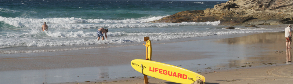
Point Lookout is Queensland's most easterly point. Many people tend to think that the coast bends eastward north of Brisbane but in fact North Stradbroke Island is the state's most easterly island. In recent times Point Lookout has become a popular vantagepoint for whale watching. Its steep cliffs afford an viewing point between June and October when the humpback whales make their way past the island on their way to the breeding grounds around Hervey Bay. They return, more slowly, from September to November. There are a number of excellent walking tracks in the area.
North Stradbroke Island Heritage Trail
The other places of interest at Point Lookout listed in the North Stradbroke Island Heritage Trail include Home Beach, the Point Lookout Hotel, Hope Plaque at Cylinder Beach, Deadmans Beach, Frenchman's Beach, the Main Beach, the Point Lookout Lighthouse, Cooks Seat, the Norfolk Pines, the Point Lookout Hall, the Surf Club, the wreck of the Prosperity and a large midden. See http://www.stradbrokemuseum.com.au/trail/# for details.
Point Lookout lighthouse
By 1825 Point Lookout was being talked about as a potential site for a lighthouse. Over 100 years later, in 1932, a lighthouse was built with the construction material and acetylene cylinders for the flame being brought to a temporary jetty on Cylinder Beach. The small lighthouse was built and the acetylene cylinders were replaced every 12 months. When the liberty ship Rufus King ran aground in 1942 on the South Passage Bar, the captain claimed he mistook the red and white Point Lookout lighthouse for the Cape Moreton Lighthouse, which was also painted red and white. To avoid confusion, the Point Lookout lighthouse was painted white and the Moreton lighthouse was painted with red and white bands. In 1988 electricity replaced acetylene and the outside steel ladder and iron wall were removed. The dome and prism were also removed and can be seen at the North Stradbroke Island Historical Museum in Dunwich. The result is one of the least-interesting lighthouses on the east coast. It is located in Lucinda Crescent at Point Lookout.
Main Beach
To the south of Point Lookout is Main Beach which, amusingly, has been known over the years as both Eighteen-Mile Beach and Twenty-Two Mile Beach. It is actually 32 km long. The view from the Surf Lifesaving Club southward is impressive. The beach is known for its vast number of shell middens where, for thousands of years, Aborigines feasted on the molluscs they collected in the area.
South Stradbroke Island
The southernmost tip of South Stradbroke is only 200 m away from the Gold Coast. The island is essentially a natural reserve with calm inner waterways to the west, peaceful and largely undisturbed native bushland with remnant livistona rainforest and melaleuca wetlands in the centre of the island, and 22 km of surf beach on the eastern side. The east coast surf beach offers views of the Gold Coast and, between June and October, it is possible to see the humpback whales migrating north to breed and heading back south. Dogs are prohibited within the Conservation Park (managed by Queensland Parks and Wildlife Services) and all three of the campgrounds managed by the City of Gold Coast. South Stradbroke is accessible from Runaway Bay marina, Sanctuary Cove Marina and Marina Mirage. For details and bookings check out http://mystraddie.com.au/visiting-south-straddie/map-and-how-to-get-there or call (07) 5577 2849.
History
* There is evidence, particularly the middens along the coast, that the Noonuccal, Nughie and Gorenpul Aboriginal people have lived on the island for at least 25,000 years, possibly for 40,000 years. The tribes were part of the Yuggera language group.
* There is some evidence that the Portuguese and Dutch may have mapped the coastline around Stradbroke as early as the mid-1550s.
* The islands (at the time it was just one island) were sighted by both Captain James Cook in 1770 - he named Point Lookout - and Matthew Flinders in 1803.
* In 1803 Flinders, sailing in the cutter Hope, landed at Cylinder Beach where the Noonuccal Aborigines helped his sailors to find fresh water.
* In 1823 three castaway timber getters - Thomas Pamphlett, John Finnegan and Richard Parsons - crossed Moreton Island and reached Stradbroke Island.
* In the 1820s Amity Point was named after the explorer, John Oxley's ship, the Amity.
* In 1825 a pilot station was established at Amity Point.
* In 1827 Governor Darling named the island Stradbroke, after the then Earl of Stradbroke. Captain H. J. Rous, the commander of the HMS Rainbow who had charted Moreton Bay, was the second son of the Earl of Stradbroke.
* In 1827 there was a proposal to move the convict settlement to the port at Dunwich and this led to the construction of a causeway and barracks remnants of which can still be seen today. The settlement was short-lived mainly because mooring in the bay was problematic. Adding to this the Goori Aboriginal people of Quandamooka were outraged when the Europeans started clearing areas which had previously been important sacred sights and bora grounds.
* The settlement was abandoned in 1831 partly because of the difficulty unloading supplies in rough weather.
* In 1849 a quarantine station was established at Dunwich.
* In 1850 the ship, Emigrant, arrived with typhus aboard. 56 people died as a result of the typhus outbreak.
* In 1864 an asylum for the aged and infirm was established at Dunwich and this was followed in 1892 by a hospital for incurable diseases with most of the patients suffering from leprosy.
* In 1893 an Aboriginal mission was established at Moongalba. It continued until 1943.
* Heavy storms in 1894-1896 led to the island being split between North Stradbroke and South Stradbroke.
* In 1932 the Point Lookout lighthouse was built.
* In 1935 Hayles Cruises started a passenger service from the mainland to Amity.
* In 1943 a Japanese submarine torpedoed the hospital ship, Centaur, off the coast.
* By 1948 North Stradbroke was part of Cleveland Shire.
* In 1950 the first shipment of mineral sands left the island.
* 1964 saw the establishment of a drive-on, drive-off barge from Cleveland to Dunwich.
* By 1971 the island was being mined for silica by ACI. They shipped the silica to Brisbane where it was used to make glass bottles.
* In the 1970s people seeking a simpler island life started settling the island. This led to the building of a high school, caravan parks, shops and churches.
* In 1988 the North Stradbroke Island Historical Museum was opened.
* 1998 saw the island's largest resort, the eco-resort Couran Cove, open for business. It was built by the well-known Olympian Ron Clarke.
* In 2000 the University of Queensland opened the Moreton Bay Research Station and Study Centre at Dunwich.
* By 2004 ACI was extracting 330,000 tonnes of sand from the island. 80,000 tonnes was processed locally and 250,000 tonnes exported.
* On 4 July, 2011 Native Title over North Stradbroke Island was proclaimed.
^ TOPVisitor Information
Redlands Visitor Information Centre, 17 Runnymede Road, Capalaba, tel: 1300 667 386 on the mainland and the Stradbroke Island Visitor Information Centre, Junner Street, Dunwich, tel: 1300 667 386.
^ TOPUseful Websites
The University of Queensland has good, detailed historic information about the island on its website. Check out http://queenslandplaces.com.au/stradbroke-island. The island's official website can be found at http://stradbrokeisland.com.
^ TOP
Do you know who Junner Street was named after? Was it ‘The Skipper’ Captain Alexander Junner or Captain George Junner. The street is on Stradbroke Island.
Thankyou
Lyndy, are you a relation of Capt Junner? It was named after him… My family are also relations of his…
Thank you that information Fiona; yes my Grandfather was George Junner, his brother was Alexander Junner.
I will try to contact you.
Can anyone tell me about an old boat wreck that used to be on the long-lost beach at Amity Point in the 1950s-60s? I was only a small child then and my parents ran the Cabarita Kiosk. Anyway, I remember the rusty wreck being called the “Bandicoot”, but I can find no record of it online.