Beautiful bay south of Sydney famed for its white sands
Jervis Bay is a complex entity. It is a series of small, holiday townships (Huskisson, Vincentia, Hyams Beach, Callala Bay) an impressive park (Booderee National Park), two lighthouses (one active, one an historic ruin), a small coastal piece of the Commonwealth of Australia (Jervis Bay Territory) and, most importantly, a huge natural harbour which, at a depth of 27 metres is thought to be the deepest sheltered harbour in Australia.
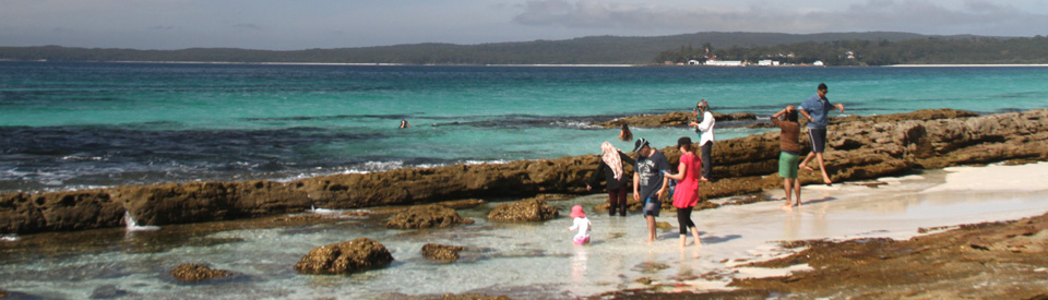
Jervis Bay is 15 km long and 10 km wide. It is noted for its remarkable white sands (reputedly the whitest in the world - but who is the judge?) which turn the waters a glorious aquamarine which becomes a deeper and deeper blue further offshore. The shores are edged by eucalypt forest, woodland, swamps, dunes, mangroves, remnants of rainforest, coastal scrub, grassland and heathlands which in spring are ablaze with wildflowers. The region has a rich geology and history with lakes and estuaries, historic lighthouses, high sand dunes, intimate coves and beaches, and cliffs up to 135 metres high. The shoreline of the bay is bisected by Currambene Creek which means that access to the southern section is via Jervis Bay Road and access to the north is via Forest Road from Nowra. The bay is a rare example of continuity of Aboriginal settlement with the local indigenous community living in a protected area near Wreck Bay on the southern peninsula and the Jerringa people living on the northern peninsula.
Location
Jervis Bay is located 198 km from Sydney via the Princes Highway.
^ TOPOrigin of Name
As early as August 1791 Lieutenant Richard Bowen named the harbour Port Jervis after the British naval officer John Jervis, who later became admiral of the British fleet. Bowen had served under Jervis. Oh, yes, and no one seems to be definitive about whether it should be pronounced "jervis" as in "her" or "jarvis" as in "jar".
^ TOPThings to See and Do
Jervis Bay is a series of small townships and beautiful beaches - most are holiday destinations - located on the shoreline of this spectacularly beautiful bay. There are separate entry points so that (a) to get to Currarong, Point Perpendicular, Callala Beach and Callala Bay it is necessary to head east from the Princes Highway at Forest Road south of Nowra. (b) to visit Huskisson, Vincentia and Hyams Beach the route from the north is via Jervis Bay Road and from the south it is Island Point Road and (c) to get to Hyams Beach, HMAS Creswell, Green Point, Bowen Island, Caves Beach, Booderee National Park, Wreck Bay, Bristol Point, Murrays Beach and Cape St George Lighthouse the easiest entry is via Jervis Bay Road from the north and Wool Road from the South.
Currarong and Point Perpendicular
Currarong is located 33 km south-east of Nowra at the northern end of the Beecroft Peninsula. It is a quiet retirement and holiday destination which is noted for its swimming, surfing, fishing and prawning. It has two boat ramps: one at Warrain Crescent and a natural ramp across the sand at Yalwal Street.
The Beecroft Peninsula is a beautiful and historic area with a diverse array of native flowers and wildlife. Bushwalking, fishing and camping are available at Honeymoon Bay on the western perimeter of the promontory.
There is a popular lookout with spectacular views at the Point Perpendicular lighthouse where there are sheer 90 metre cliffs. The lighthouse was built in 1899 to replace the Cape St George Lighthouse on the southern headland. The tower is believed to be a first in New South Wales to be erected on a flat concrete base and to be constructed of concrete blocks - made on the ground - lifted into position, then cement-rendered on both the inside and the outside. It is 93 metres above sea level, can be seen 26 nautical miles (42 km) out to sea, is 21.4 metres high and was automated in 1993.
Point Perpendicular headland has two walking tracks: (1) the Wreck Walk (1 hour) which overlooks the remains of the SS Merimbula which was wrecked at Beecroft Head in March, 1927 and (2) the longer, three hour Trig Station walk. The peninsula is an ideal location for whale (I have seen over 20 whales off Point Perpendicular in October), dolphin and seal spotting and becomes a blaze of colour in spring when the wildflowers are in bloom.
Callala Bay and Callala Beach
Located on the northern shoreline of Jervis Bay are the tiny holiday-retirement towns of Callala Bay, Callala Beach and Myola. They are separated from Huskisson and Vincentia by Currambene Creek and are isolated from the main urbanised area which lies to the south. No one is sure what 'Callala' means. It is either from 'kallala' (meaning 'fish') or from one of Alexander Berry's convicts, Patrick Smith, who lived in the area and was born at Calala in Ireland. Apart from its peacefulness, the area is known for its water activities - swimming, sailing, snorkelling and fishing. There are boat ramps at both Myola and Callala Bay.
Huskisson
Over the past two decades Huskisson has grown from a sleepy holiday resort and fishing port to a town on the shores of Jervis Bay with a buzz produced by excellent dolphin watching cruises, the beauty and appeal of the bay and the rapid growth of nearby villages - Vincentia and Hyams Beach. Huskisson has a holiday air about it. The main street is full of cafes, takeaway shops, a dive shop, places where cruises can be booked and central to everything is a large waterfront hotel - The Husky Pub - where daytrippers and holidaymakers can sit in the beer garden, enjoy a meal at the Sports Bar or Brasserie and soak up the relaxed holiday ambience. There is a detailed, separate entry on Huskisson. See https://www.aussietowns.com.au/town/huskisson-nsw.
Vincentia
Beyond Huskisson is the small holiday town of Vincentia. It was originally known as South Huskisson but was renamed in 1952. It takes its name, Vincentia, because Admiral John Jervis, after whom Jervis Bay was named, was also the Earl of St Vincent. It is a typical holiday town with a small shopping centre and pleasant beaches which are mostly used for fishing, windsurfing, sailing and diving. The Vincentia shoreline is 6.5 km long and includes pristine white beaches including Blenheim, Greenfields, Collingwood and Orion. There is more information at http://www.visitnsw.com/destinations/south-coast/jervis-bay-and-shoalhaven/vincentia.
Hyams Beach
The unchallenged fashionable destination on Jervis Bay is Hyams Beach, a quiet village which claims to have the whitest sand in the world and is popular with wedding parties and people prepared to pay large sums for holiday accommodation overlooking the bay. Michael Hyam received a grant of 41 acres of waterfront land in 1859 and the beach and town are named after him. Hyams Beach is a popular diving spot with some enthusiasts comparing it favourably with the Great Barrier Reef. Certainly there are a number of shallow reefs in 8-10 metres of water off the shore and they are home to a wide variety of temperate marine life. For more information check out http://www.visitnsw.com/destinations/south-coast/jervis-bay-and-shoalhaven/hyams-beach. The cafe at the beach has maintained a high reputation for good food and coffee for decades although it has changed ownership a number of times.
HMAS Creswell
Located on the south-western shores of Jervis Bay in the area known as Jervis Bay Territory (it is Federally controlled and is the maritime component of the Australian Capital Territory - it is not part of New South Wales) is HMAS Creswell. The entire naval complex was named on the Australian Heritage Commission's National Estate in 1981. Of particular significance are the main buildings around the quadrangle - the Clock Tower, the Dining Hall, the College Hospital and the two-storey timber Commandant's House - which have all been listed for preservation by the National Trust. The predominant architectural values expressed in the highly geometrical layout and design of the college are formality, symmetry and simplicity. All of the original buildings are of weatherboard with red tiled roofs. Incorporating touches of Georgian and classical design they are impressive examples of Australian colonial architecture. For a detailed history of the site's changing relationship with the Australian Navy (it is currently home to the Navy's Advanced Leadership and Management Faculty (ALMF) which conducts the Junior Officer Leadership, Management and Strategic Studies courses, and both phases of the Senior Sailor Advanced Staff Skills course as well as the RAN School of Survivability and Ship's Safety and the lead establishment for firefighting, damage control, and nuclear, biological and chemical defence training. It is also home to the Navy's Lead Authority for Leadership and Management training) check out http://www.navy.gov.au/establishments/hmas-creswell.
Booderee Botanic Gardens
The Commonwealth Government’s decision to excise the “Jervis Bay Territory” from New South Wales always seemed wildly eccentric. The argument was that Canberra (the national capital) being landlocked, the Commonwealth needed access to the sea. In 1915 the area bounded by Jervis Bay to the north, the coastal cliffs to the east, Wreck Bay to the south and Sussex Inlet and St George’s Basin to the west all became part of the Australian Capital Territory.
In 1951 the Canberra-based Australian National Botanic Garden, needing a frost-free area for research into mild climate plants and knowing that Canberra was too cold in winter, developed part of an old farm (it had been known as Bherwerre and had been used for timber and dairy since 1900) near Wreck Bay as an mild climate botanic annex. For the next 44 years this annex was known as the Jervis Bay Botanic Gardens. The only criterion for plantings at the annex was their need to be frost free. The small local Yuin and Wadi-Wadi Aboriginal community at Wreck Bay worked at the Gardens. Today many of the paths, rock walls and garden beds are the result of their labours.
In 1995 the Botanic Garden was handed over to the Wreck Bay community, it was renamed Booderee Botanic Gardens, it became jointly managed by the local community and the Director of National Parks and, most significantly, the non-indigenous plants were slowly removed so that now it is a collection of the flora of south eastern Australia’s coastal environment and it is “the only Aboriginal owned botanic gardens in Australia.” The result is a wonderland of flora including lemon-scented tea tree, bottle brush (callistemon), waratah, Gymea lily, orange, pink and yellow flowering gums, cabbage trees, turpentine, blackwood and bloodwood amongst which fauna such as red belly black snakes, diamond pythons, 10,000 pairs of the eastern long-necked turtle in Lake McKenzie (a perched lake in the gardens) and over two hundred species of birds, including crimson rosellas, rainbow lorikeets, kookaburras, wood ducks and satin bowerbirds.
Booderee Botanic Garden is being returned to its former indigenous glory. Already there is 3.7 km of easily accessible tracks through the wooded landscape, across the open lawns and beside Lake McKenzie. The trails pass the Heath and Woodland Garden which focuses on South Coast flora; the Casuarina Lawn which is particularly popular with the glossy black cockatoo; the Waratah Lawn which is an ideal place for picnics; the Rainforest Gully with its tree ferns and palms; and the Koori Garden which, given the new Aboriginal ownership, is emphasising the bush tucker and bush medicine aspects of the flora.
During the school holidays there is an extensive program of Aboriginal activities for kids including Bush Tucker and Medicines, Aboriginal Tools and Technology, Koori Games, Campfire Yarns, and a Twilight Walk. Check at the Visitor Centre for details. Booderee National Park is open daily according to the time of the year. Entry to the Botanic Gardens is free but it costs to enter Booderee National Park. Tel: (02) 4443 0977, check out http://www.environment.gov.au/parks/booderee.
Green Patch
Located beyond the Royal Naval College and Booderee Botanic Gardens, Green Patch is a popular camping ground and beach destination. There are picnic tables, sheltered barbecues, toilets, hot showers and an excellent sheltered child-friendly beach. The birdlife around the campground is prolific, the flora is diverse, there are dolphins and penguins to be seen in the Bay and kangaroos about the campsite. For more information and rates for camping check out http://www.parksaustralia.gov.au/booderee/plan/camping.html.
Bristol Point
Bristol Point campground is located beyond Green Patch. It is designed to cater for larger camping groups and the facilities include toilets, hot showers, fresh water and barbecues. It is not designed for caravans or camper-trailers. There are pleasant walking trails through the surrounding woodland and low heathland which is rich in wildflowers in spring. There is a Rock Platform Nature Trail out to Bristol Point and around the rocky shore. For more information and rates for camping check out http://www.parksaustralia.gov.au/booderee/plan/camping.html.
Murrays Beach
Beyond Green Patch and Bristol Point is Murrays Beach, which many consider the watery highlight of Booderoo National Park. It has a large carpark. There is a short bushwalk to the shore of Jervis Bay which has pure white sands (all the beaches in the bay are superb) as well as a rocky outcrop. It is necessary to walk 1.4 kilometres around a rocky point to reach this stunningly beautiful beach. A walking trail (the Munyunga waraga dhugan (loop walk)) leads to Governor Head with its 90-120 metre high sandstone cliffs. The trail continues south where coastal scrub gives way to heathland. The cliffs are dramatic and defined by their beautiful layered, coloured sandstone. They continue down the coast to St George Head and the ruins of Cape St George lighthouse.
The Parks Australia website (http://www.parksaustralia.gov.au/booderee/do/walks.html) describes the walk: "The Munyunga waraga dhugan loop walk is an ideal introduction to Booderee. ‘Munyunga waraga dhugan’ means ‘white-bellied sea eagle's home camp’ in the Dhurga language of the Wreck Bay Aboriginal people. The walk is a self-guided tour of Booderee’s plants, animals, culture and history told through the 14 signs you’ll discover along the way. Take in panoramic views of Jervis Bay, from Governor Head check out the park’s sea birds, penguins, seals, dolphins and whales. If you start early in the morning you might catch a glimpse of the endangered eastern bristlebird. Keep your ears open for a variety of our other wildlife - birds, frogs and animals." The walk is defined as "Moderate Grade", is 5.4 km loop and will take around 2.5 hours. Murrays Beach is an excellent destination for diving with shallow and deep-water rock reefs, seagrass meadows, silty sand-flats, platforms and caves. There is also a pleasant walk to Hole in the Wall which is 1.1 km along the beach and takes around 30 minutes.
Bowen Island
Bowen Island is now off-limits to anyone other than researchers and conservationists involved in the maintenance of the small island's delicate ecosystem. It can be clearly seen from most of the beaches on the southern shores of Jervis Bay. It lies directly opposite Governors Head and is nothing more than 51 ha of heath, woodland and Lomandra tussocks. In 1985 there were six houses which had been built during World War II when the island was used for defence purposes. On the north of the island are World War II gun emplacement sites facing out to sea, mountings for heavy guns, lookout posts and underground complexes for barracks and magazine stores. The island is home to sooty shearwaters and its population of 5,000 mating pairs of little penguins (previously known as fairy penguins) led to it being reclaimed by the Commonwealth Government in 1985. It is the northernmost penguin rookery in Australia. The sign on the shore opposite the island explains: "Our little penguins mate for life returning to the same burrow at mating time from June to August. To prepare for their clutch of eggs the couples clean out their burrows and make repairs. The females get ready for egg laying by eating grit for strong egg shells. Egg laying begins in September and usually finishes by mid October. If the season is good two clutches may be hatched." It goes on to explain that "The protected waters of Jervis Bay ensure a good supply of pilchards and anchovies reducing the need for exhausting fishing trips to the continental shelf." The island is also home to a number of Aboriginal sites of archaeological importance including shell middens and rock shelters.
Cape St George and Cape St George Lighthouse
Cape St George is a sublime contrast to the beaches in Jervis Bay. It has sheer cliffs rising over 100 metres above the Tasman Sea. It offers dramatic views along the coast and it is home to a fascinating remnant of the early history of the area. Cape St George was named by Captain James Cook who sailed past on 23 April, 1770 which happened to be St George's Day.
Due to a series of shipwrecks - by 1859 there had been nine shipwrecks on the cape - it was decided that a lighthouse was necessary for safe navigation. The signage at the ruin explains what went wrong: "In 1857, the colonial architect Alexander Dawson and an assistant surveyor E.F. Millington, investigated Cape St George for sites suitable for a lighthouse. Unfortunately, Dawson's choice of sites were largely based on ease of construction, rather than efficient function of lighthouses. Without the input of any maritime expertise, the chairman of the Pilot Board authorised the first of Dawson's site options. Almost immediately, the project was plunged into controversy. Despite glaring deficiencies in the planning stage, and disagreement by a majority of the board, the lighthouse was commissioned on 1 October, 1860. Thirty eight years and may arguments later, a replacement lighthouse shone its beam from the northern side of Jervis Bay, at Point Perpendicular. Even unlit the lighthouse caused navigational problems especially on moonlit night when the golden sandstone tower glowed in the dark. Near the turn of the century explosive charges were used to reduce the tower and parts of the keeper's quarters to rubble."
In 1876 40 men drowned when the S.S. Dandenong was shipwrecked. This resulted in the construction of the Point Perpendicular Lighthouse. The Point Perpendicular Lighthouse was built on the northern peninsula in 1899. The Cape St George lighthouse was demolished in 1901. It is still fascinating to explore the ruins.
Cave Beach and Bherwerre Beach
Cave Beach is considered one of the quietest and prettiest beaches on Jervis Bay. It is located in Booderee National Park, administered by the Wreck Bay Aboriginal community, and offers simple camping with cold showers, camping areas under the trees, and opportunities for fishing, swimming, bushwalking and diving. A 300 metre long trail leads from the car park through the coastal scrub to the Cave Beach campsite. To the west of the campsite where a trail passes through rainforest and reaches Bherwerre Beach there are views to the south and west of the mangroves and swamps which edge the shores of St Georges Basin. The dune vegetation at Bherwerre Beach is threatened by the introduced Bitou bush which is now a pest although it was introduced to stabilise the dunes. Other walks in the area include a fire trail which heads south-west through blackbutt forest, coastal tea-tree and re-vegetated dunes down to Bherwerre Beach. It is 1.9 km. From that walk there is a 200 m detour to Ryans Swamp which, when flooded, is alive with egrets, ibises, swamp hens and herons. For more information check out http://www.visitnsw.com/destinations/south-coast/jervis-bay-and-shoalhaven/jervis-bay/accommodation/booderee-national-park-cave-beach.
Wreck Bay
Wreck Bay is an 87 ha Aboriginal settlement which is edged by a series of sandy bays and sheltered beaches on the southern side of Cape St George. The area is accessible via Wreck Bay Road which runs south from Jervis Bay Road. The Aboriginal community is responsible for the day-to-day administration of the Booderee National Park and they run a number of cultural activities for visitors. Most visitors to the area head for Summercloud Bay, a small and attractive cove with a ramp, toilets, picnic tables, barbecues and drinking water which is edged by Blackbutt forest and a rock platform which is popular with divers and snorkellers. The cliffs around Cape St George to Governor Head start at Summercloud Bay. The peninsula is characterised by secluded sandy coves, rock platforms, dense eucalypt forest and sheer cliffs. The track south to St George Head passes through forest, woodland, coastal scrub and patches of rainforest and there are short tracks which head towards Shelleys Point, Whiting Beach, Blacks Harbour, Kittys Beach, Kittys Point and Corangamite. The trail to the southernmost point leads to spectacular ocean views at St George's Head (it is 4.1 km or 1.5 hours walk). The 135 metre cliffs on the headland are thought to be the highest on the New South Wales coast. Further around the coast is Steamers Beach. From the car park it is possible to walk through the eucalypt forest (a distance of 2.3 km) to the sublime, isolated Steamers Beach which is flanked on both sides by high cliffs and backed by steep sand dunes covered with tea-trees. Around Steamers Head the heathland is alive with wildflowers in spring and summer.
History
* Prior to the arrival of Europeans members of the Tharawal and Yuin Aboriginal language groups had been living around the bay for at least 20,000 years.
* There is evidence that the bay was formed 11,000 years ago, after the last ice age, which means that the Tharawal were living in the area at the time of the bay's formation. The Tharawal moved around the bay and tended to camp on headlands, along the beaches and in more secluded rock shelters. Their diet comprised shellfish, fish from the estuaries, small marsupials, penguins and mutton birds which they caught on Bowen Island.
* The first European to see the bay was Captain James Cook who, in April 1770, wrote in his diary of a "point of land which I had discovered on St George's Day, and which therefore I called Cape George." When he reached the bay Cook recorded that it "promised shelter from the north east winds, but as the wind was with us, it was not in my power to look into it without beating up, which would have cost me more time than I was willing to spare".
* The harbour was named "Jervis Bay" in August, 1791 by Lieutenant Richard Bowen. He named it after Sir John Jervis who later became Admiral of the British fleet.
* Through the 1790s whalers from Twofold Bay used the harbour as a convenient anchorage.
* In 1801 naturalist and explorer George Caley arrived aboard the Lady Nelson and wrote favorably of the flora, fauna and the safety of the harbour.
* In 1805 a 20 ton sloop named Nancy ran aground at Steamers Bay. The survivors took eleven days to walk to Sydney.
* In 1811 Governor Lachlan Macquarie landed on Bowen Island and subsequently recommended a settlement on the shores of the bay.
* In 1818 the explorers, Charles Throsby and Hamilton Hume, descended from the Southern Highlands to Jervis Bay.
* By 1819 the Surveyor-General John Oxley had reached the bay and reported that there was not "the smallest inducement for the foundation of a Settlement on its shores, being ... for the most part Barren and generally deficient in Water".
* In 1822 Aboriginal people were moved to Wreck Bay when Alexander Berry took over land in the Shoalhaven.
* Land grants were issued in 1827 and land was taken up by cedar cutters and dairy farmers.
* The first land grant in the St Georges Basin area was to Lieutenant John Lamb who was granted 2,560 acres (1037 ha) on 20 May, 1830 which he named Erowal. The property was managed by David Blair and a number of convicts developed the site.
* In 1841 the bay was connected by The Wool Road from Nerriga in the Southern Highlands. The track was originally cut by about 70 convicts in ten months at the behest of Governor Gipps in order to take wool, wheat, hides, etc from the Braidwood, Goulburn and Canberra areas to the coast for shipping to Sydney. It passed St Georges Basin and finished at South Huskisson.
* The settlement of Huskisson was established on the western shore of the Bay in 1840. A hotel, wharf and wool store were erected at South Huskisson. Coastal steamers and whaling ships regularly visited the bay.
* In 1857 the Colonial Architect, Alexander Dawson, investigated the possibility of establishing a lighthouse at Cape St George.
* In 1859 Michael Hyam received a grant of 41 acres of waterfront land which subsequently was named Hyams Beach.
* In 1860 the Cape St George Lighthouse was built. It was badly located and as a result it became a navigational hazard.
* In 1876 40 men drowned when the S.S. Dandenong was shipwrecked. This resulted in the construction of the Point Perpendicular Lighthouse.
* By the 1880s Jacob Ellmoos took up 100 acres at Sussex Inlet.
* Point Perpendicular Lighthouse was built on the northern peninsula in 1899. The Cape St George lighthouse was used as target practice by the Navy and was demolished in 1901.
* In 1911 the decision to create an independent territory with access to the sea led to 7,400 ha of Jervis Bay being carved off New South Wales. It was a Commonwealth owned and controlled port and naval base.
* By 1915 the Royal Australian Naval College had opened at Captain Point under Federal administration. It was subsequently named HMAS Creswell.
* In 1928 the shipwreck of the SS Merimbula resulted in passenger services by sea being stopped on the South Coast.
* The Wreck Bay area was designated a reserve in 1928 but, by the time it was gazetted in 1952, the extent of the reserve had shrunk considerably.
* In 1931 the British adventurer Sir Francis Chichester landed his aeroplane in Jervis Bay at the end of the first east-west flight across the Tasman Sea from New Zealand to Australia. A school for Aboriginal children was opened at Wreck Bay.
* In 1951 the Jervis Bay Botanic Gardens were created.
* In 1964 HMAS Melbourne collided with the HMAS Voyager during a naval exercise 20 nautical miles off Jervis Bay and 82 men died.
* In 1971 two-thirds of the Territory (4470 hectares) was declared a natural reserve.
* In 1976 Jervis Bay was classified by the National Trust of Australia in recognition of its conservation, scenic, scientific, historical and recreational value. Cape St George Lighthouse, Bowen Island and HMAS Creswell were included on the Register of the National Estate.
* In 1985 Bowen Island Nature Reserve was officially declared.
* In December, 1995 large sections of the national park at Jervis Bay were handed over to the Wreck Bay Aboriginal community as part of the reconciliation process. The agreement saw the land leased back to the Federal Government for 99 years in return for a share of the income the park generates and a majority presence on the management board. The current occupants are all descended from, or related to, the original inhabitants. Many of the sites are of great significance to them, especially the Reserve Cemetery, fishing spots at Summercloud Bay and Mary Bay, as well as traditional lookouts, meeting places and camping areas.
* In 1998 Jervis Bay National Park was renamed Booderee National Park.
^ TOPVisitor Information
The best information on the area can be accessed at the Huskisson Visitor Information Centre at the Lady Denman Maritime Museum, 11 Dent Street, Huskisson, tel: (02) 4441 5999 and Booderee National Park Visitor Information Centre, Jervis Bay Road, Jervis Bay, tel: (02) 4443 0977.
^ TOPUseful Websites
The local website - http://www.jervisbaytourism.asn.au - has useful information about accommodation, eating and the National Parks in the area.
^ TOP
Would like to know how the Beecroft Penisula name came about please?
It is my understanding that Jervis Bay was to be the ‘deep sea port’ for Canberra, the national capital of australia, and a railway line was to be built from Jervis Bay to Canberra, although (apparently for political reasons), this never eventuated. I have also been told that the original rail route is still, ocasionally re-surveyed, but I cannot confirm this. (I was a Canberra resident from 1954 til 2003, but am now resident in NSW).
You are quite correct. The railway line was surveyed in 1909 but never built. Part of the problem was the very steep descent from the plains around Canberra to the sea.
Where did the name “Darling Road” Jervis Bay come from?
Probably from Governor Ralph Darling. He was Governor of New South Wales from 1825-1831. Maybe a local has more reliable information.
Hello, we’d love to know what Currambene means — is it a local Indigenous word?